Antique Map of Cheshire by Emanuel Bowen, circa 1767
This original antique map of Cheshire was produced by Emanuel Bowen and published circa 1767 in the Large English Atlas. Entitled "An Accurate Map of the County Palatine of Chester", it is a detailed eighteenth-century depiction of the historic county.
The map includes geographical detail together with information about Cheshire's commerce, agriculture and history. A decorative vignette of Chester Cathedral adds visual interest, making this an attractive example of Bowen's work as an eighteenth-century mapmaker.
This example has later hand colouring and a good engraved imprint. It is laid on board and shows some age toning. The map measures approximately 340 x 240 mm (13.25 x 9.5 inches). Please note that its mounting affects shipping arrangements outside the UK mainland.
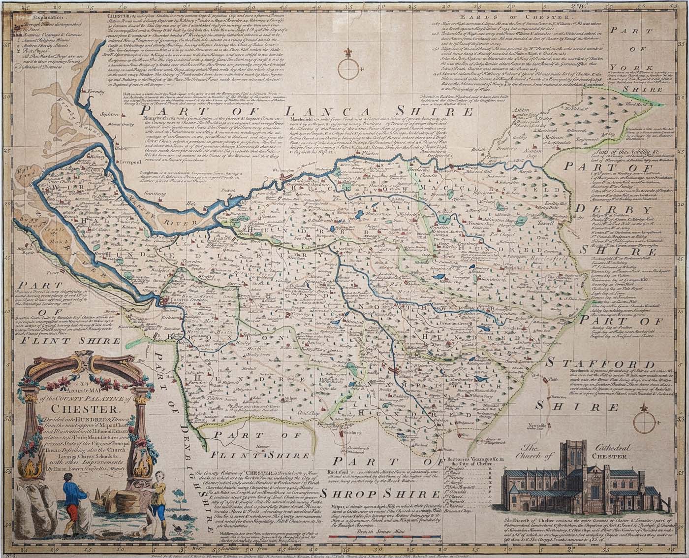
18th-century antique map of Cheshire by Emanuel Bowen
Map title: An Accurate Map of the County Palatine of Chester
Mapmaker: Emanuel Bowen
Publication: The Large English Atlas
Date: Circa 1767
Publishers: Printed for R. Sayer, T. Kitchin, H. Overton, T. Bowles, J. Bowles & Son, and others.
Features: Detailed county map with text on Cheshire's commerce, agriculture and history, and a vignette of Chester Cathedral.
Condition: Good imprint, later hand colouring, laid on board and some age toning. Priced to reflect condition.
Map size: Approximately 340 x 240 mm (13.25 x 9.5 inches).
Price: £195.00
Order number: 4617
Please email for a shipping quotation outside the UK mainland, as this map is laid on board.
About Emanuel Bowen and the Large English Atlas
Emanuel Bowen (c.1694–1767) was a prominent eighteenth-century mapmaker and engraver who produced maps of Britain and other parts of the world. His work is valued for its geographical detail and the historical information included on many maps.
The Large English Atlas brought together detailed county maps of England and Wales. Bowen's map of Cheshire combines cartographic information with descriptive text and a decorative view of Chester Cathedral.
This original antique Cheshire map is an interesting piece of eighteenth-century cartography and is available to buy from Antique Maps Online.
View our other antique maps of Cheshire or browse more antique maps by Emanuel Bowen.
Frequently Asked Questions
Who made this antique map of Cheshire?
The map was produced by Emanuel Bowen, an eighteenth-century mapmaker and engraver.
When was the Cheshire map published?
It dates from approximately 1767 and appeared in the Large English Atlas.
What is the condition of this antique map?
This example has a good engraved imprint and later hand colouring. It is laid on board and has some age toning. The condition is reflected in the asking price.
Can this map be shipped outside the UK?
Please contact us before ordering for an overseas shipping quotation, as the map is laid on board.
Mon - Closed
Tues-Fri 10am-1.30pm, 2.30-5.30pm
Sat 10am-1.30pm
 Free UK Mainland Delivery*
9 Church Street
Modbury
Devon PL21 0QW. UK
01548 830872