
Antique Maps of Derbyshire
Antique Maps of Derbyshire for Sale
Explore our collection of original antique maps of Derbyshire, featuring historic county maps dating from the late 17th century to the 19th century. These fascinating maps illustrate the historic landscape of Derbyshire, including its towns, villages, estates and surrounding countryside.
Our collection includes decorative and detailed maps by renowned cartographers such as Robert Morden, Thomas Moule, Christopher and James Greenwood, Archibald Fullarton and Sidney Hall. Each map offers a unique historical record of the county, with examples featuring original or later hand colouring and attractive engraved detail.
Historic places shown on these maps include Derby, Chesterfield, Bakewell, Belper and Wirksworth, making them particularly interesting to collectors, local historians and anyone with a connection to Derbyshire.
Browse our selection below to find an original antique Derbyshire map. We offer a range of prices and provide free UK mainland delivery.
Click on any map image or product description below to view further details, photographs and purchasing information. FREE UK Mainland Delivery.

Decorative antique map of Derbyshire by Thomas Moule,
featuring the county's towns and countryside.
1836-48
£77.00

Antique engraved county map of Derbyshire by
Archibald Fullarton, dating from the early 19th century.
c.1833
£59.00

Detailed antique map of Derbyshire by Greenwood,
including an attractive cartouche depicting Chatsworth House.
c.1839
£75.00
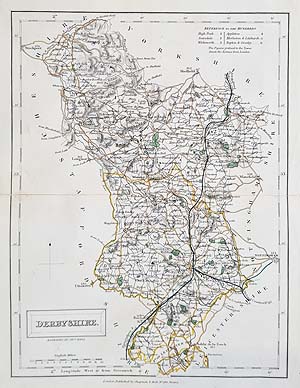
19th century engraved map of Derbyshire by Sidney Hall,
showing the historic county and its principal settlements.
c.1835
£25.00
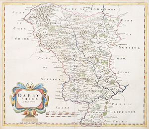
Scarce 17th century antique map of Derbyshire by
Robert Morden, featuring his characteristic decorative title cartouche.
c.1695
£115.00
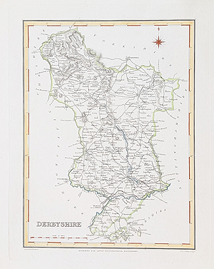
Antique map of Derbyshire by Robert Creighton and
J. & C. Walker, published in the early 19th century.
c.1831
£34.95
The History of Antique Derbyshire Maps
Derbyshire has a fascinating history of cartography, with county maps produced by some of Britain's most respected mapmakers.
One of the earliest maps in our collection is by Robert Morden, dating from approximately 1695. His maps are recognised for their distinctive engraved lettering and decorative title cartouches.
The 19th century saw the production of increasingly detailed and decorative county maps. Thomas Moule's Derbyshire map, published between 1836 and 1848, is particularly attractive, featuring an elaborate border, heraldry and decorative illustrations.
Christopher and James Greenwood's map, dating from circa 1839, is another notable example. It is larger and more detailed, with an attractive cartouche depicting Chatsworth House, one of Derbyshire's most celebrated historic estates.
Other cartographers represented include Archibald Fullarton, Sidney Hall and Robert Creighton with J. & C. Walker. Their maps provide an interesting record of Derbyshire before the major changes brought about by modern transport and urban development.
Original antique maps of Derbyshire make attractive additions to collections and are particularly appealing as gifts for people with family, historical or geographical connections to the county.
Explore More Antique Maps of the British Counties
If you are interested in historic county maps, you may also enjoy browsing our collections of:
- Antique Maps of Staffordshire
- Antique Maps of Nottinghamshire
- Antique Maps of Leicestershire
- Antique Maps of Yorkshire
- Antique Maps of Cheshire
- Antique Maps of the British Isles
Discover more historic maps from across England, including decorative county maps from the 17th, 18th and 19th centuries.
Frequently Asked Questions About Antique Derbyshire Maps
What is the earliest antique map of Derbyshire available?
Our collection includes a map of Derbyshire by Robert Morden dating from approximately 1695, alongside maps from the 18th and 19th centuries.
Who produced antique maps of Derbyshire?
Notable cartographers include Robert Morden, Thomas Moule, Christopher and James Greenwood, Archibald Fullarton and Sidney Hall.
Are your Derbyshire maps original antiques?
The maps offered are original historical prints rather than modern reproductions. Please refer to each individual product description for details of its condition, colouring and publication history.
Do you offer free delivery on antique Derbyshire maps?
Yes. We offer free UK mainland delivery on our antique maps.
Can antique Derbyshire maps be framed?
Yes. We offer free UK mainland delivery on our antique maps. For further information, see our delivery information.
Mon - Closed
Tues-Fri 10am-1.30pm, 2.30-5.30pm
Sat 10am-1.30pm
© Devonshire Fine Art
 Free UK Mainland Delivery*
9 Church Street
Modbury
Devon PL21 0QW. UK
01548 830872


