
Antique Maps of Bristol
Explore our collection of antique maps of Bristol, including historic city plans, town maps and maps of the surrounding area dating from the 17th, 18th and 19th centuries. These original antique maps record the changing city, its streets, harbour, suburbs and surrounding countryside. The collection includes maps by John Rapkin, John Tallis, William Lander, Ashmead and other notable cartographers and publishers.
We also offer historic sea charts of the Bristol Channel and River Avon, reflecting Bristol's importance as a major port and centre of maritime trade. These charts show the coastline, navigational approaches and ports around the Bristol Channel and provide an additional perspective on Bristol's maritime history. Many of the maps in this collection are original antique maps rather than modern reproductions. Individual listings provide information about the cartographer, date, dimensions, condition and price where available.
- Historic plans and city maps of Bristol.
- Antique maps of Bristol and the surrounding area.
- 18th and 19th-century maps and town plans.
- Historical maps showing Bristol's streets, suburbs, harbour and surrounding countryside.
- Antique nautical charts of the Bristol Channel.
- Original antique maps and charts, subject to individual availability.
Click on an image or map title to view the full description, historical details, condition, price and availability.
Antique Maps and Plans of Bristol
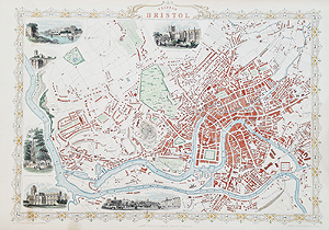 Bristol and Clifton Antique Map by John Rapkin and John Tallis
C.1851
£345.00
View map
This attractive 19th-century map of Bristol and Clifton by John Rapkin and John Tallis provides a historical view of the city during the Victorian period. It shows Bristol and the surrounding area at a time of continuing urban and commercial development.
 Bristol – Antique City Map by Ashmead, 1871
Ashmead (hand annotated by a Railway Engineer)
1871
SOLD
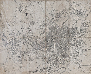
Antique map of Bristol circa 1825
After Ashmead
circa 18251
£95.00
Antique Maps of Bristol and the Surrounding Area
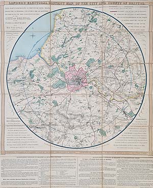
Bristol Electoral District Antique Map
William Lander
C.1840
£695.00
View map
This 19th-century electoral district map of Bristol by William Lander provides a different perspective on the city, showing its political divisions during a period of substantial urban growth.
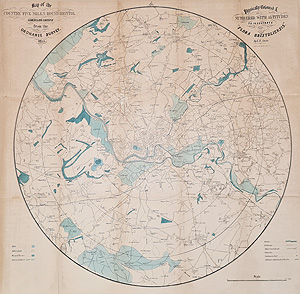
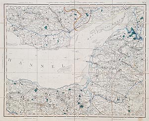

Antique Map of Bristol and Bath by Thomas Moule
c. 1840
£68.00
View map
Historic Maps of Bristol Harbour and the River Avon
Our collection of antique Bristol maps also includes historic charts of the Bristol Channel, River Avon and approaches to Bristol. Dating from the 17th, 18th, 19th and early 20th centuries, these charts illustrate the development of nautical surveying and Bristol's importance as a historic trading port.
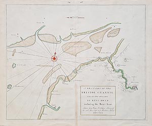
Bristol Channel – Antique Nautical Chart by Edmond Halley & John Senex, c.1728
£325.00
View chart
An early 18th-century chart of the Bristol Channel associated with Edmond Halley and John Senex. The chart records the coastline and navigational approaches to Bristol and the surrounding ports.
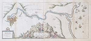
River Avon and Bristol – Antique Chart by Greenville Collins, c.1693
Double page
£495.00
View chart
An important early chart of the River Avon and approaches to Bristol by Captain Greenville Collins, dating from around 1693. The chart illustrates the navigational importance of the Avon and Bristol's position as a major historic port.
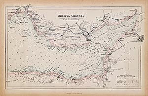


Bristol Channel – Antique Chart by Jacob Theunisz, c.1679
£595.00 Now £340.00
View chart

Bristol Channel – Antique Chart by Pieter Goos, c.1650–1685
£595.00 Now £340
View chart

English & Bristol Channel – Antique Chart by Gustav Klint, 1823
£595.00
Now £340.00
View chart

Bristol Channel – Antique Chart by Hendrick Doncker, c.1659–1672
£545.00 Now £300.00
View chart


Historic Maps of Bristol and the Development of the City
Historic maps provide an unusually detailed record of Bristol's development as a city and port. Maps from the 18th and 19th centuries show the River Avon, Bristol Harbour, Clifton, surrounding villages and the gradual expansion of the built-up city. They are particularly useful for studying local history, genealogy, architecture and changes to the landscape.
Our collection of antique maps of Bristol includes historic city plans, maps of the surrounding Bristol area and early sea charts of the Bristol Channel. The maps date from the 17th, 18th and 19th centuries and provide a fascinating record of Bristol's development as an important West Country city and international port.
Historic maps of Bristol can show parts of the city that have changed considerably over the centuries, including the River Avon, Bristol Harbour, Clifton, surrounding villages and the approaches to the city. They are particularly interesting for anyone researching local history, genealogy, architecture or the changing landscape of Bristol.
The collection also includes antique charts of the Bristol Channel, showing the coastline of Somerset, Devon and South Wales and the approaches to the River Avon and Port of Bristol. Early examples by renowned cartographers such as Greenville Collins, John Seller, Pieter Goos, Johannes van Keulen, Edmond Halley and John Senex demonstrate how nautical charting developed during the 17th and 18th centuries.
Whether you are looking for a historic map of Bristol as a decorative piece, a gift, a record of the city's past or an addition to a collection, our Bristol maps offer an original connection with the history of the city and the surrounding region.
We regularly add new maps and charts to our collection, so please check the latest stock or contact us if you are looking for a particular period, cartographer or area around Bristol.
Antique Maps Online specialises in original antique maps and charts, with individual listings providing information on cartographer, date, provenance, dimensions and condition where available. We are members of the Antiquarian Booksellers Association and the International League of Antiquarian Booksellers
Mon - Closed
Tues-Fri 10am-1.30pm, 2.30-5.30pm
Sat 10am-1.30pm
© Devonshire Fine Art
 Free UK Mainland Delivery*
9 Church Street
Modbury
Devon PL21 0QW. UK
01548 830872


