
Antique Bristol Channel Sea Chart, c.1728 – Edmund Halley and John Senex
This scarce antique chart of the Bristol Channel dates from around 1728 and depicts the approaches to Bristol through the River Severn and River Avon. Associated with Edmund Halley and John Senex, the copperplate engraving is based on Captain Holliday's survey and records coastal settlements along the Somerset and Welsh shores. The chart is offered for sale for £325.
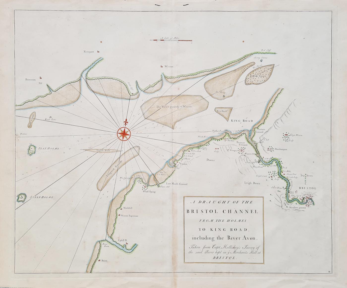
Details of the Antique Bristol Channel Chart
Title: A Draught of the Bristol Channel from the
Holmes to King Road, including the River Avon.
Date: Circa 1728
Cartographers and contributors: Edmund Halley,
John Senex and Nathaniel Cutler
Survey: Based on Captain Holliday's survey
Technique: Copperplate line engraving
Image size: 456 × 545 mm (approximately
18 × 21.5 inches)
Total size stated in the listing: 522 × 1180 mm
Price: £325.00
Order number: 4192.
Condition: Some age toning and discolouration to centrefold, several wormholes, later hand colouring. Copperplate line engraving. Very scarce.
Geographical Detail: Somerset, Wales and the River Avon
The chart depicts the Bristol Channel and the approaches to Bristol, including sections of the Somerset and Welsh coast. The original place names include Weston Super Mare, Clevedon and Portishead, alongside coastal settlements near Cardiff and Newport. The River Avon is shown leading towards Bristol, with detail of the town and its surrounding landscape.
History of Atlas Maritimus et Commercialis
This chart is associated with Atlas Maritimus et Commercialis, an eighteenth-century maritime atlas containing geographical descriptions, sailing directions and sea charts. The publication was produced in the context of competition between contemporary navigational atlases and pilot books.
Condition of the Antique Chart
The chart has some age toning and discolouration around the centrefold, several wormholes and later hand colouring. It is a copperplate line engraving. Please examine the photographs and contact us if you require further condition details.
Edmund Halley and John Senex
Edmund Halley was an astronomer and mathematician whose work included the study of navigation, geomagnetism and oceanography. John Senex was a map publisher and engraver active in the early eighteenth century. Both are important figures in the history of British cartography.
Historical Background: Edmund Halley and John Senex
Edmond Halley (8 November 1656 - 25 January 1742)
One of the great names in the history of astronomy and cartography. A celebrated mathmetician
, Fellow of the Royal Society, the second Astronomer Royal in succession to Flamsteed, his name is perpetuated in the name of Halley's Comet, the orbit of which he calculated.
As a young man he spent two years in St. Helena taking observations and in the years 1698-1700 took part in voyages in the North and South Atlantic studying meterology, magnetic variations and ocean currents. The charts he issued as a result of his studies were widely used and reproduced.

Halley by
Richard Phillips
John Senex
A publisher and engraver a contemporary of Herman Moll and perhaps to some extent a rival, though his output was somewhat smaller. Together with Charles Price and James Maxwell (fl. 1708-14), he produced some fine maps of the world and the continents as well as maps of various countries.
He also seems to have specialised in road maps and in 1719 he issued a corrected edition of Ogilby's Britannia, in miniature form which was published in various editions, five of which after his death by his widow. There was also a pirated copy by Thomas Kitchin.
His works include:
A New Map of Great Britain (with Charles Price) c.1710.
Atlas (20 maps without title) 1712.
The English Atlas 1714.
An Actual Survey of all the principal roads of England and Wales 1719-77 ( French Ed. 1759).
World and the Continents 1719.
A new General Atlas of the World 1721.
Hertfordshire - Re-issue of John Norden's map first published in 1593-98, 1723.
Explore more antique sea charts and maritime maps, antique maps of Somerset and antique maps of Bristol.
For more historical maps of Britain, browse our antique maps of the British Isles.
For advice on displaying your purchase, see our antique map framing suggestions.
Frequently Asked Questions
When was this Bristol Channel chart published?
The chart is dated circa 1728 in this listing. The precise publication details should be confirmed against the chart and its associated atlas.
Who is associated with the chart?
The chart is associated with Edmund Halley and John Senex, with Nathaniel Cutler also mentioned in the historical attribution. It is based on a survey by Captain Holliday.
What area does the chart show?
It depicts the Bristol Channel, parts of the Somerset and Welsh coasts, and the approaches to Bristol through the River Avon.
What is the condition of the chart?
The listing records age toning and centrefold discolouration, several wormholes and later hand colouring. Please inspect the photographs and contact us for further details.
Is the chart available to buy?
This antique Bristol Channel chart is offered for sale for £325. Please use the Add to Cart button to order, subject to availability.
Mon - Closed
Tues-Fri 10am-1.30pm, 2.30-5.30pm
Sat 10am-1.30pm
© Devonshire Fine Art
 Free UK Mainland Delivery*
9 Church Street
Modbury
Devon PL21 0QW. UK
01548 830872


