
Antique Sea Chart of the River Avon and Bristol, c.1693
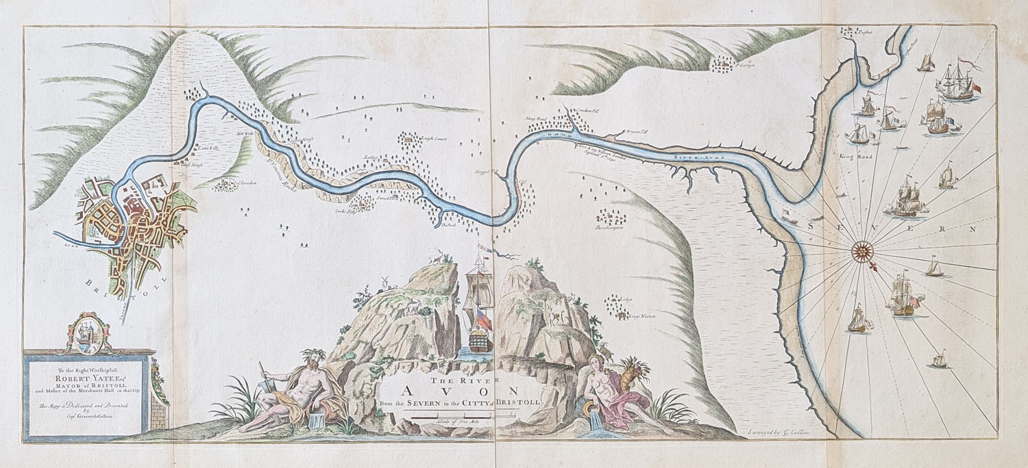
This original antique sea chart of the River Avon and Bristol was produced by Captain Greenville Collins around 1693 for his influential nautical atlas, Great Britain's Coasting Pilot. Depicting the waterways approaching Bristol, coastal shipping and a town plan of the city, the chart provides a fascinating record of the region's maritime history. Printed on four conjoined sheets with later hand colouring, it measures approximately 400 × 930mm. This historic Bristol sea chart is offered for sale at £495.
Original Title of the Greenville Collins Chart
The River Avon from the Severn to the Citty of Bristoll
Description of the Antique Bristol Sea Chart
This large seventeenth-century nautical chart depicts the waterways and approaches associated with Bristol. Features include Clevedon, Portishead, Hot Wells, a town plan of Bristol and numerous ships in the channel. A historical annotation records the landing of King William on 6 September 1690.
Condition and Physical Details
- Date: circa 1693
- Mapmaker: Captain Greenville Collins
- Publication: The British Coasting Pilot
- Medium: Printed chart with later hand colouring
- Construction: Four conjoined sheets
- Image size: 400 × 930mm (approximately 16 × 36.5 inches)
- Condition: Good paper and bold imprint, with some age toning
- Price: £495
- Order number: 4763
About Captain Greenville Collins
Captain Greenville Collins was commissioned in 1676 to survey the coasts of Great Britain. His work culminated in The Great Britain's Coasting Pilot, published in 1693, an important early English-produced sea atlas. Collins worked with engravers to prepare the charts for publication.
Captain Greenville Collins and His Coastal Surveys
Captain Greenville Collins was a British naval officer and hydrographer whose work helped to improve knowledge of the waters around the British Isles during the seventeenth century. Commissioned during the reign of Charles II to undertake a systematic survey of the coastline, Collins produced charts intended to assist mariners navigating the often difficult waters around Britain.
His surveys culminated in Great Britain's Coasting Pilot, first published in 1693. This important nautical atlas brought together detailed coastal charts, providing practical information for shipping and navigation at a time when maritime trade was central to Britain's commercial prosperity. Collins's work represented a significant advance in British hydrography, combining coastal observations with the developing art of printed mapmaking.
Antique charts associated with Greenville Collins are valued for both their historical importance and their distinctive cartographic character. They offer a fascinating record of how Britain's coastline, harbours and navigable waterways were understood and represented by early modern mapmakers.
The River Avon and Bristol in the Seventeenth Century
The River Avon has long been an important waterway for Bristol, connecting the historic port with the Bristol Channel and wider maritime trade routes. Early nautical charts of this area provide an insight into the geography that shaped Bristol's development as a major trading centre.
This historic chart focuses on the River Avon and the surrounding coastline, including places such as Clevedon, Portishead and Hot Wells, near Bristol. The waterways and coastal settlements illustrate the relationship between the river, the Bristol Channel and the communities that depended upon them for transport, trade and communication.
The sailing vessels depicted on the chart add to its maritime interest, evoking a period when coastal shipping was essential to the movement of goods and people. These details also demonstrate the practical purpose of early sea charts, which helped mariners understand coastal approaches and navigate unfamiliar waters.
For collectors interested in Bristol's history, this antique River Avon chart offers a visual connection with the region's maritime heritage and the development of navigation along one of its most important waterways.
Collecting Antique Bristol Sea Charts
Antique sea charts appeal to collectors for their combination of historical significance, geographical detail and decorative character. Early charts of the Bristol Channel and River Avon are particularly interesting because they document the waterways that supported centuries of regional commerce, coastal navigation and maritime exchange.
Collectors of British cartography may be drawn to these works for their early representations of familiar coastlines, while maritime historians value them as evidence of the techniques used to survey and describe Britain's shores. Place names, coastal outlines, navigational features and sailing vessels can all provide clues to how the region was understood by mapmakers and mariners of the period.
An original antique Bristol sea chart also makes an attractive addition to a collection of historic maps, particularly alongside charts of the Bristol Channel, the English coastline and other important British ports. Whether collected for its connection with Bristol's maritime past or displayed for its historical and decorative appeal, an early nautical chart brings together the history of navigation and the art of traditional mapmaking.
Explore our related collections: antique maps of Bristol, antique maps of Somerset and antique sea charts and nautical maps to discover more historic cartography of the region and Britain's coastline.
Mon - Closed
Tues-Fri 10am-1.30pm, 2.30-5.30pm
Sat 10am-1.30pm
© Devonshire Fine Art
 Free UK Mainland Delivery*
9 Church Street
Modbury
Devon PL21 0QW. UK
01548 830872


