
Antique Map of Bristol and Surrounding Area, 1853, by E. W. Swete
This scarce antique map of Bristol and the surrounding countryside was produced in 1853 by E. W. Swete and lithographed by Lavars of Bridge Street, Bristol. Compiled chiefly from the Ordnance Survey, the circular map records railways, mail coach roads, churches, gentlemen's seats and variations in the surrounding landscape. Its original hand colouring and connection with the botanical work Flora Bristoliensis make it an unusual historical record of the Bristol area in the Victorian period.
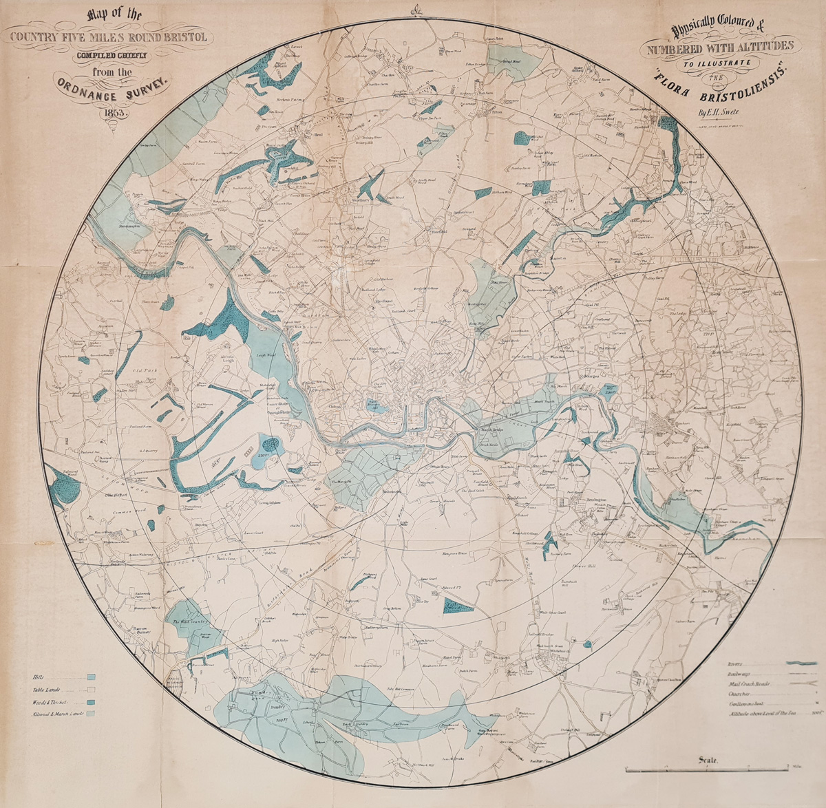
Antique Map of Bristol, 1853 — Product Details
- Mapmaker: E. W. Swete
- Publisher / lithographer: Lavars, Bridge Street, Bristol
- Date: 1853
- Title: Map of the Country Five Miles Round Bristol
- Subject: Bristol and surrounding countryside
- Features: Railways, roads, churches, landscape and altitude information
- Technique: Hand-coloured lithograph, as described in the listing
- Condition: Folding copy laid on board, with repaired losses, splits to folds and age discolouration
- Size: Approximately 530 x 530 mm (21 x 21 inches)
- Order number: 4265
- Price: £495.00
Explore framing options for antique maps
£495.00*
As this map is laid on board, extra shipping will apply to destinations outside the UK, please email for prices.
Order No. 4265
Explore More Antique Maps of Bristol and Somerset
Discover more antique maps of Bristol, including historic plans and maps of the city and surrounding district. Browse our collection of antique city maps or explore antique maps of Somerset for further examples of historical cartography.
Frequently Asked Questions
Who made the 1853 antique map of Bristol?
The map is attributed to E. W. Swete and was lithographed by Lavars of Bridge Street, Bristol.
What area does the map cover?
The circular map is centred on Bristol and covers an area approximately five miles around the city, extending to Barrow Gurney, Whitchurch, Blaise Castle and Frenchay.
What features are shown on the map?
The map records railways, mail coach roads, churches, gentlemen's seats and landscape features, with information about altitude and a separate key for different land types.
What is the condition of the map?
The folding map is laid on board. The recorded condition includes two small repaired areas of loss, splits along folds and age discolouration. Original hand colouring is present.
How large is the map?
The stated image size is approximately 530 x 530 mm, or 21 x 21 inches.
How much does the map cost?
The listed price is £495.00. Additional shipping charges may apply to destinations outside the UK because the map is laid on board. Please enquire before ordering.
Mon - Closed
Tues-Fri 10am-1.30pm, 2.30-5.30pm
Sat 10am-1.30pm
© Devonshire Fine Art
 Free UK Mainland Delivery*
9 Church Street
Modbury
Devon PL21 0QW. UK
01548 830872


