
Antique Map of Bristol and Bath by Thomas Moule, c.1836–1848
Discover this decorative antique map of Bristol and Bath by Thomas Moule, published in connection with Barclay's English Dictionary and dated circa 1836–1848. Featuring views of St Mary Redcliffe and other local details, the map names Bristol, Bath and Keynsham, recording the historic character of this part of western England. This original nineteenth-century map has later hand colouring, a bold printed impression and close borders as published. Available from Antique Maps Online for £68.00, it is an attractive piece for collectors of antique maps, Bristol and Bath history, and British topography.
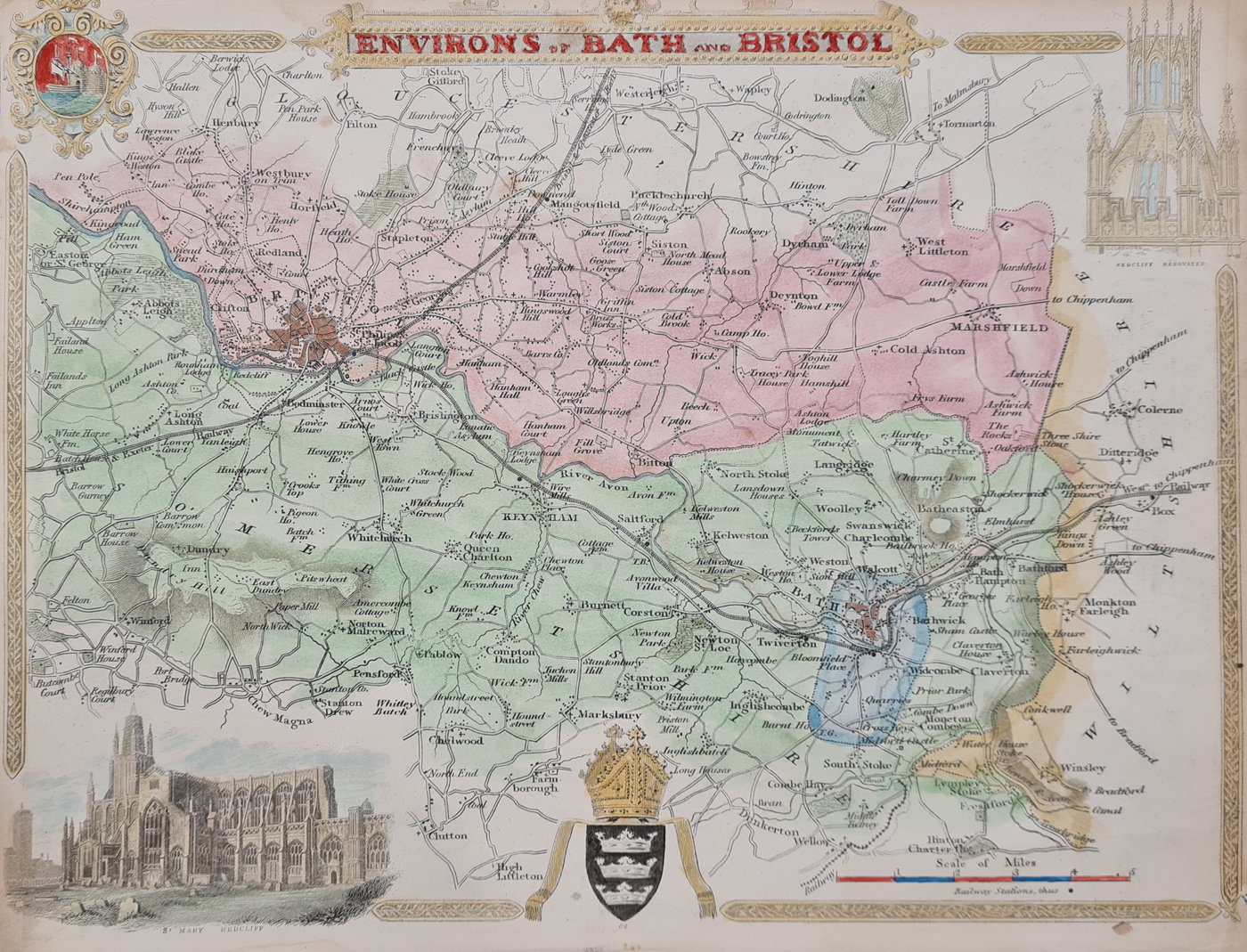
Environs of Bristol and Bath by Thomas Moule
Mapmaker: Thomas Moule
Date: c.1836–1848
Publication: Barclay's English Dictionary
Description: Decorative antique map of the environs of Bristol and Bath, with vignettes of St Mary Redcliffe and other local features. Named places include Bristol, Bath and Keynsham.
Condition: Good paper with a bold printed impression, later hand colouring and close borders as published.
Printed map dimensions: 210 × 270 mm (approximately 8.25 × 10.5 inches)
Price: £68.00
Order number: 4117
About This Antique Map of Bristol and Bath
This decorative map of Bristol, Bath and the surrounding countryside is associated with the work of Thomas Moule, known for his illustrated maps of British counties. It combines geographical detail with decorative vignettes, making it of interest to collectors of antique maps of Somerset, Bristol and the historic cities of western England.
Thomas Moule and His Maps
Thomas Moule (1784–1851) was an English mapmaker and antiquarian particularly known for his decorative county maps. His maps often combine geographical information with architectural illustrations and ornamental details. These features make his work appealing to collectors interested in British history, topography and cartography.
Bristol and Bath in the Nineteenth Century
Bristol was an important port and commercial centre, while Bath was renowned for its Georgian architecture and spa heritage. Historical maps of the area help illustrate the relationship between these cities and the surrounding towns and countryside during the nineteenth century.
Condition and Collecting Information
This example has a bold printed impression, later hand colouring and close borders as published. Please refer to the photographs and the condition description above when assessing the map. The printed image measures approximately 210 × 270 mm.
Explore More Antique Maps
Antique Maps of Somerset | Thomas Moule Maps | Antique Maps of Bath | Antique Maps of Bristol | Antique City Maps
Frequently Asked Questions
Who made this antique map of Bristol and Bath?
The map is attributed to Thomas Moule, an English mapmaker known for decorative maps of British counties.
What date is the map?
The map is catalogued as circa 1836–1848. This approximate date should be confirmed against the map's publication details.
What condition is the map in?
The paper is described as good, with a bold printed impression, later hand colouring and close borders as published.
What are the dimensions?
The printed map measures approximately 210 × 270 mm (8.25 × 10.5 inches).
Can the map be framed?
Framing options are available through the selections on this product page. The additional cost depends on the framing and glass option chosen.
Mon - Closed
Tues-Fri 10am-1.30pm, 2.30-5.30pm
Sat 10am-1.30pm
© Devonshire Fine Art
 Free UK Mainland Delivery*
9 Church Street
Modbury
Devon PL21 0QW. UK
01548 830872


