
Antique Map of Devonshire by Emanuel Bowen and W. Owen, 1759
About this Antique Map of Devonshire
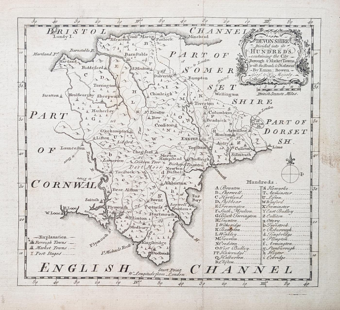
This attractive antique map of Devonshire was produced by Emanuel Bowen and W. Owen and published in 1759 in The Natural History of England, Volume 1. Dating from the mid-18th century, it is a decorative historical representation of the county of Devon, combining geographical detail with the distinctive engraving style of the period.
The map includes important Devonshire towns and settlements, including Exeter, Plymouth and Dartmouth. It provides an interesting glimpse of the county's geography and place names as they were represented in the 18th century.
This is the second edition of the map. It has a good imprint and Uncoloured, with minor age-related blemishes consistent with its age. Its relatively compact size makes it suitable for display in a study, library or traditional interior.
Map Details
- Cartographers: Emanuel Bowen and W. Owen
- County: Devonshire, England
- Date: 1759
- Publication: The Natural History of England, Volume 1
- Edition: Second Edition
- Colour: Uncoloured
- Condition: Good imprint with minor age-related blemishes
- Image size: 175 x 195mm (approximately 7 x 7.5 inches)
Price: £85.00
Reference: 5029
Original antique map supplied with free UK mainland delivery.
Explore our antique map framing service
For further information, see our antique map delivery information.
About the Cartographer Emanuel Bowen (c.1694–1767)
An 18th century map and print seller and engraver to King George II and Louis XV of France, who worked in London from about 1714, producing some of the best and attractive maps of the century. A recurring feature of Bowen's work, evident even on the early road maps, was his habit of filling every corner and space of the map with jottings and footnotes, both historical and topographical.
He had plans for completing a major county atlas but, finding the task beyond his means, joined with Thomas Kitchin to publish The Large English County Atlas. Many of the maps were individually issued from 1749 and the whole atlas was finally completed in 1760.
One of his earliest engraved works Britannia Depicta, published in 1720 contained over two hundred road maps together with a miniature county map of each of the counties of England and Wales. It was an unusual feature of the atlas that the maps were engraved on both sides of each page, and this resulted in a handier sized book.
He also issued with John Owen a book of road maps based, as was usual at the time, on Ogilby but again incorporating his own style of historical and heraldic detail.
Thomas Bowen was his son, while Thomas Kitchin and Thomas Jefferys were among his apprentices.
In spite of his royal appointments and apparent prosperity he died in poverty and his son, who carried on the business was no more fortunate and died in a Clerkenwell workhouse in 1790.
Explore more historic maps by Emanuel Bowen, including his important 18th-century maps of the British counties.
Explore our collection of antique maps of Devonshire to discover other historical maps of the county.
Frequently Asked Questions
Who produced this antique map of Devonshire?
The map was produced by Emanuel Bowen and W. Owen and published in 1759.
Is this an original antique map?
Yes. This is an original 18th-century map, rather than a modern reproduction.
What condition is the map in?
The map has a good imprint, uncoloured with minor age-related blemishes.
Can this antique map be framed?
Yes. We offer an antique map framing service. Please see our map framing page for further information.
Is delivery included?
Free UK mainland delivery is available. Please see our delivery information for details.
Mon - Closed
Tues-Fri 10am-1.30pm, 2.30-5.30pm
Sat 10am-1.30pm
© Devonshire Fine Art
 Free UK Mainland Delivery*
9 Church Street
Modbury
Devon PL21 0QW. UK
01548 830872


