
Antique Map of Devon and Cornwall by George Augustus Walpoole, 1790
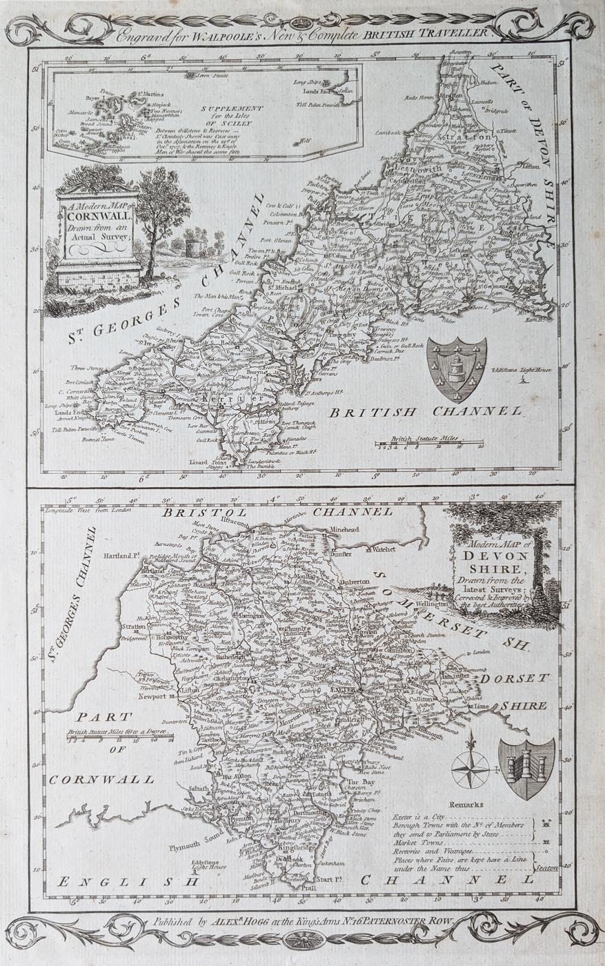
Antique Map of Devon and Cornwall, 1790
Title: A Modern Map of Devon and Cornwall, Drawn from the Latest Surveys; Corrected and Improved by the Best Authorities.
Publication: The New British Traveller, published by Alexander Hogg, London.
Date: 1790
Cartographer: George Augustus Walpoole.
Engraver: Hatchett.
Description: An attractive and scarce late 18th-century antique map of Devon and Cornwall, from the second edition of The New British Traveller. The two county maps feature decorative vignette-style title cartouches, with an ornamental key and coat of arms on the Devon map. The Cornwall map includes an inset of the Isles of Scilly.
Condition: Uncoloured, with good paper and a clear imprint. Some minor age toning.
Image size: 320 x 197mm (approximately 12.5 x 7.75 inches).
Price: £125.00
Order number: 5023
Georgian Antique Map of Devon and Cornwall by Walpoole, 1790
George Augustus Walpoole was associated with The New British Traveller, a geographical publication produced by Alexander Hogg in London. Published in the late eighteenth century, this work contained a collection of county maps covering England and Wales.
The maps in The New British Traveller were notable for their decorative presentation, incorporating engraved title cartouches, ornamental details and other embellishments.
This scarce antique map of Devon and Cornwall dates from 1790 and is an attractive example of Georgian-era British cartography. The two county maps feature distinctive vignette-style title cartouches, while the Devon map includes a decorative key and coat of arms. The Cornwall map also contains an inset of the Isles of Scilly.
Measuring approximately 320 x 197mm, this original uncoloured map offers an interesting historical representation of two neighbouring counties in southwest England. Its decorative engraving and regional historical interest make it an appealing piece for collectors of antique maps of Devon and Cornwall.
Browse our antique maps of Devon and Cornwall to discover further original maps dating from the seventeenth to nineteenth centuries.
Mon - Closed
Tues-Fri 10am-1.30pm, 2.30-5.30pm
Sat 10am-1.30pm
© Devonshire Fine Art
 Free UK Mainland Delivery*
9 Church Street
Modbury
Devon PL21 0QW. UK
01548 830872


