
Antique Map of Devonshire by Joshua Archer, 1842
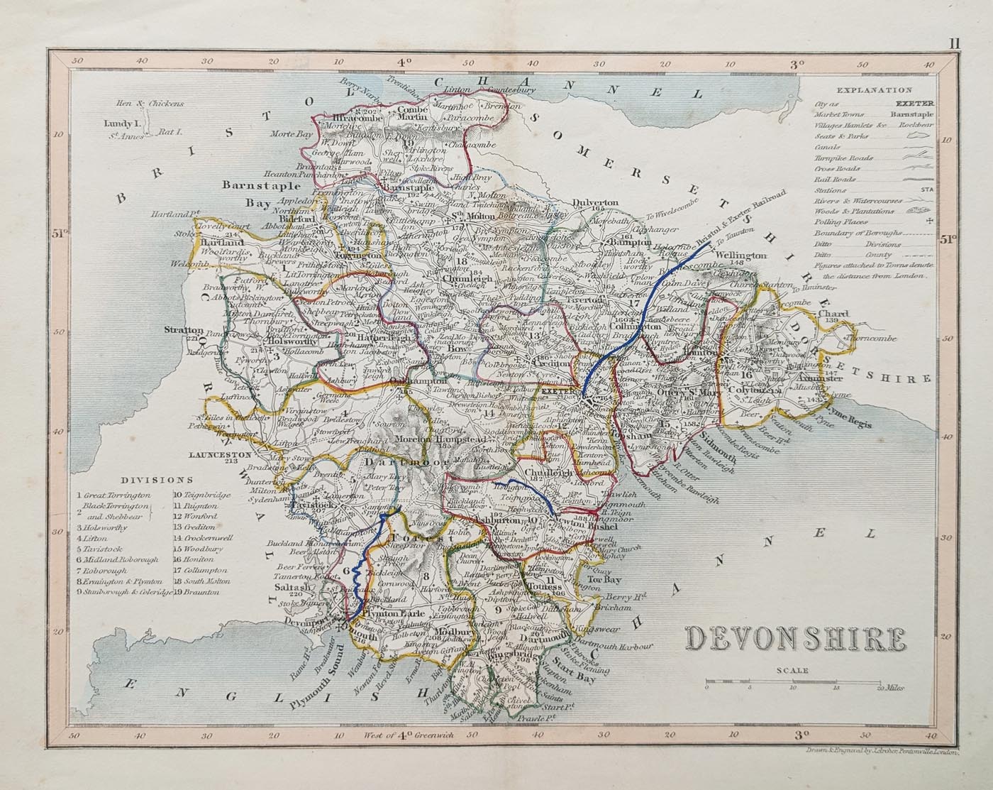
Antique Map of Devonshire, 1842
This original antique map of Devonshire dates from 1842 and shows the county divided into ten administrative divisions. It includes a table of hundreds in the upper right-hand corner and attractive early hand colouring.
Title: Devonshire
Cartographer / Engraver: Joshua Archer
Publisher: London. L. Tallis
Publication: Curiosities of Great Britain. England and Wales Delinieated.
Date: 1842
Description: Detailed county map showing ten divisions, with a table of hundreds in the upper right-hand corner.
Condition: Good imprint and paper, minor age-related blemishes, with attractive early hand colouring.
Price: £35.00
Order No: 5024
About this Antique Map of Devonshire
This original antique map of Devonshire was published in 1842 and provides an interesting historical depiction of the county during the early Victorian period. The map is divided into ten administrative divisions, with a useful table of hundreds in the upper right-hand corner.
The map features attractive early hand colouring and is an appealing example of nineteenth-century county cartography. Its detailed geographical presentation makes it of interest to collectors of antique maps of Devon and those with an interest in the history of the county.
Joshua Archer and Nineteenth-Century Map Publishing
Joshua Archer was a prolific nineteenth-century engraver and publisher of maps. His work included maps produced for a number of geographical and topographical publications, including Thomas Dugdale's Curiosities of Great Britain.
Joshua Archer (fl. 1841 - 1861) was prolific engraver of maps. He had produced a series of maps for William Pinnock, a part series of Diocese maps for the British Magazine , some maps for Henry Fisher, and engraved a set for Thomas Dugdale's Curiosities of Great Britain. These Dugdale maps were engraved by Archer to replace those by Cole and Roper found in the early copies of Dugdale's historical and topographical gazetter-style work.Details of the Antique Devonshire Map
- County: Devonshire
- Date: 1842
- Publication: London
- Divisions: Ten
- Features: Table of hundreds
- Colour: Early hand colouring
- Condition: Good imprint and paper, minor age-related blemishes
- Price: £35.00
Antique Map Framing
This original antique map can be purchased unframed or with a choice of framing options. Visit our antique map framing page to explore the available frames and glazing options.
Explore More Antique Maps of Devon
Discover more historic maps of Devonshire in our collection of antique maps of Devon. Our collection includes maps from different periods, allowing you to explore how the county has been represented by cartographers over the centuries.
You can also browse our antique maps of the British Isles and see the latest additions to our collection.
Mon - Closed
Tues-Fri 10am-1.30pm, 2.30-5.30pm
Sat 10am-1.30pm
© Devonshire Fine Art
 Free UK Mainland Delivery*
9 Church Street
Modbury
Devon PL21 0QW. UK
01548 830872


