
Antique Fox Hunting Map of Devonshire by John and Charles Walker, c.1868
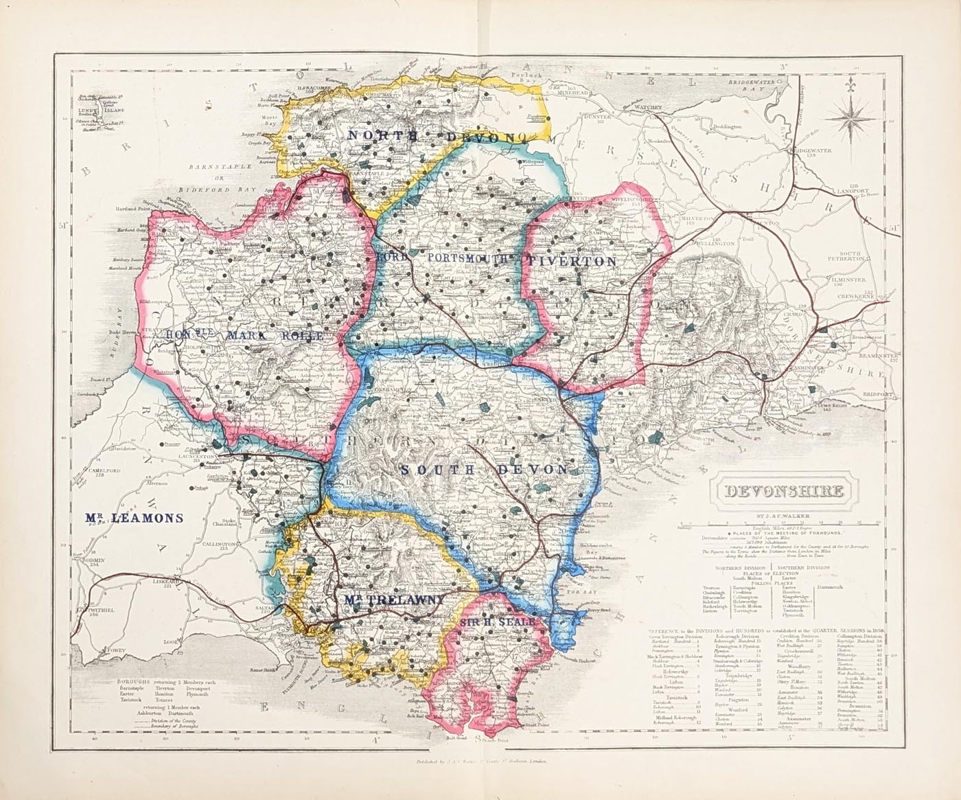
Antique Fox Hunting Map of Devonshire, c.1868
Purchase this antique map
£85.00
By John and Charles Walker
An original 19th-century folding map of Devonshire, showing fox hunting territories across Devon and East Cornwall, with printed coloured boundaries and traditional hunt meeting places.
Order number: 5012
Free UK Mainland Delivery
Antique map framing suggestions
About this Antique Fox Hunting Map of Devonshire
This unusual antique map of Devonshire was produced by the renowned 19th-century cartographers John and Charles Walker. It is particularly interesting for its depiction of the different areas hunted by the various packs of foxhounds across Devon and parts of East Cornwall.
The map is overprinted with coloured boundaries identifying the territories of the different hunts, together with numerous locations marking the traditional meeting places of the foxhounds.
Unlike conventional county maps, which concentrate primarily on towns, roads and geographical features, this map provides a fascinating insight into the history and organisation of fox hunting in Victorian Devonshire.
An attractive and unusual piece of Devonshire cartographic history, it will appeal to collectors of antique maps, enthusiasts of local history and those interested in the history of fox hunting.
Antique Map Details
- Map: Devonshire
- Cartographers: John and Charles Walker
- Date: 1868
- Publisher: 2 castle St. Holborn, London.
- Publication date: c.1868
- Colouring: Printed colour
- Dimensions: 387 x 327mm (approximately)
- Format: Folding map
- Condition: Original folding map as published, with good paper, colour printing and bold imprint
- Order number: 5012
- Price: £85.00
About this map
This later edition of the Devonshire map, originally published in 1836, provides an interesting record of fox hunting territories in Devon and East Cornwall. Coloured boundaries distinguish the areas hunted by different packs of foxhounds, while numerous place names identify their traditional meeting places.
An unusual example of Victorian sporting cartography, the map offers an insight into the history of fox hunting and the geography of the different hunts across the region.
Explore our collections of antique maps by John and Charles Walker, antique maps of Devon and antique maps of Cornwall.
Fox Hunting in 19th-Century Devon
During the 19th century, fox hunting was an established part of rural sporting life in Devon and neighbouring Cornwall. Different packs of foxhounds hunted their own territories, with traditional meeting places serving the surrounding countryside.
This unusual map records these hunting areas through coloured boundaries and named locations, providing an interesting historical document of the sporting and social geography of Victorian Devonshire.
Frequently Asked Questions
Who produced this antique fox hunting map of Devonshire?
The map was produced by the British cartographers John and Charles Walker, known for their detailed 19th-century maps and geographical publications.
What does the fox hunting map show?
It shows the different hunting territories of the foxhound packs in Devon and East Cornwall, with coloured boundaries and locations identifying traditional meeting places.
Is this an original antique map?
Yes. This is an original 19th-century map, not a modern reproduction.
How large is the map?
The map measures approximately 387 x 327mm.
Can this antique map be framed?
Yes. We can offer advice on suitable framing. Please see our antique map framing suggestions or contact us for further information.
How much does the antique fox hunting map cost?
The map is available for £85.00, with free UK mainland delivery.
Mon - Closed
Tues-Fri 10am-1.30pm, 2.30-5.30pm
Sat 10am-1.30pm
© Devonshire Fine Art
 Free UK Mainland Delivery*
9 Church Street
Modbury
Devon PL21 0QW. UK
01548 830872


