
Antique Mileage Chart of Devon by Emanuel Bowen, c.1720
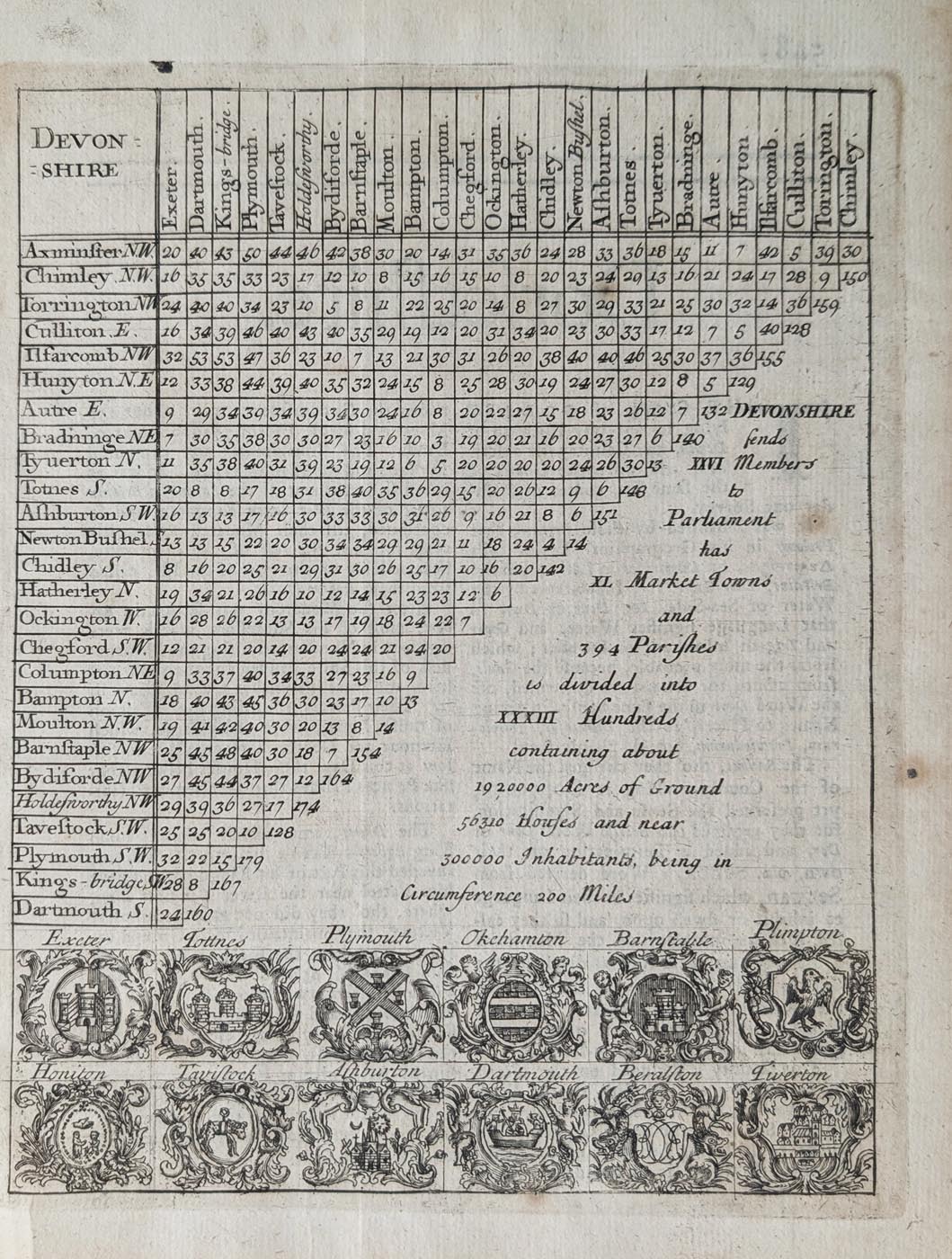
Antique Mileage Chart of Devon, c.1720
Title: Devon Shire.
Publication: Britannia Depicta, published by Thomas Bowles.
Date: c.1720.
Cartographer: Emanuel Bowen.
Description: An attractive eighteenth-century antique mileage chart of Devonshire, showing distances between towns and featuring a detailed historical inscription and twelve decorative coats of arms.
Condition: Uncoloured, with good paper and a clear imprint. Some minor age toning and marginal marks.
Image size: 187 x 145mm (approximately 7.5 x 5.75 inches).
Price: £85.00
Order number: 5013
About this Antique Mileage Chart of Devon
This fascinating original antique mileage chart of Devon was drawn by Emanuel Bowen and published by Thomas Bowles around 1720. It appeared in Britannia Depicta, an illustrated road atlas of Great Britain containing county maps and geographical information for travellers.
Entitled Devon Shire, this decorative eighteenth-century chart provides an interesting historical record of the county, combining geographical information with details of its towns, parliamentary representation and local administration.
An unusual feature is the extensive inscription describing Devonshire's historical statistics. It records that the county sent 26 Members to Parliament, contained 40 market towns and 394 parishes, and was divided into 33 hundreds. It also gives contemporary estimates of the county's acreage, number of houses, population and circumference.
Along the bottom of the chart are twelve decorative coats of arms representing important towns in Devon, adding considerable visual interest to this early Georgian mileage map.
Uncoloured and attractively engraved, this small-format antique map is an interesting example of early eighteenth-century British cartography. It offers a glimpse of how Devon was described and understood more than 300 years ago.
The map measures approximately 187 x 145mm (7.5 x 5.75 inches). It is in good condition, with clear printing and some minor age toning and marginal marks.
An appealing and historically informative antique mileage chart of Devon, suitable for collectors of early British maps, Devonshire history and Georgian decorative prints. See our other antique maps of Devon for further examples of historic county cartography.
Mon - Closed
Tues-Fri 10am-1.30pm, 2.30-5.30pm
Sat 10am-1.30pm
© Devonshire Fine Art
 Free UK Mainland Delivery*
9 Church Street
Modbury
Devon PL21 0QW. UK
01548 830872


