
Antique Map of Bath, 1803 by Chantry and Hancock
This scarce antique map of Bath dates from 1803 and was drawn by T. Chantry, Surveyor of Bath, and engraved by R. Hancock. Published for J. Savage and W. Meyler, the detailed town plan includes a table of references and depicts notable features including The Circus, the Royal Crescent and the boundary of the old city. The map has been dissected and laid on linen and measures approximately 465 x 525 mm. Price: £495.
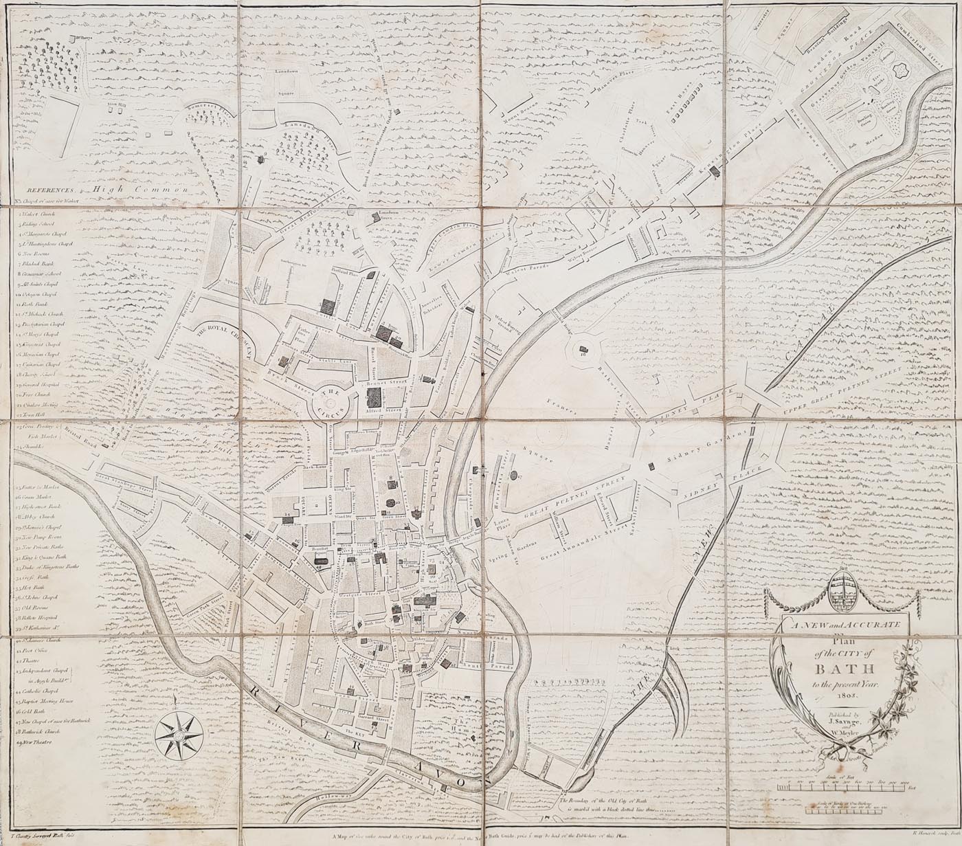

A New and Accurate Plan of the City of Bath to the Present Year 1803
Cartographic title: A New and Accurate Plan of the City of Bath to the Present Year 1803
Surveyor / Draughtsman: T. Chantry, Bath
Engraver: R. Hancock, Bath
Publisher: J. Savage and W. Meyler (verify spelling against the original imprint)
Date: 1803
Publication note: The original notice refers to a map of five miles around the City of Bath and the New Bath Guide being available from the publishers.
Description: Scarce early nineteenth-century town plan of Bath, with a table of references on the left. The map extends from Cumberland Street in the east to Bristol Road in the west and depicts The Circus, the Royal Crescent and the boundary of the old city. It has a decorative shield-shaped title cartouche.
Condition: Dissected and laid on linen, with age toning and spotting, wear at the folds. Please examine the photographs for the condition of this individual example.
Image size: 465 x 525 mm (approximately 18.25 x 20.75 inches).
Price: £495.00
Order number: 4194
Antique map framing suggestions
Bath in 1803: a Georgian town plan
This scarce plan offers a historical view of Bath in 1803, with a table of references to help identify locations across the town. The plan includes The Circus, the Royal Crescent and the boundary of the old city, making it of interest to collectors of antique maps of Bath and the history of Georgian urban development.
Drawn by T. Chantry, Surveyor of Bath, and engraved by R. Hancock, the map has a decorative shield-shaped title cartouche. This example has been dissected and laid on linen; age toning, spotting and wear at the folds should be considered when assessing its condition.
Condition and dimensions
The map has been dissected and laid on linen. The recorded condition includes age toning, spotting and wear at the folds. The image measures approximately 465 x 525 mm (18.25 x 20.75 inches). Buyers should review the photographs and contact us if they need further condition details.
Explore more antique maps of Bath and Somerset
Browse our antique maps of Bath to discover other historic plans of the city. You can also explore our antique maps of Somerset and our wider collection of antique town maps.
Frequently Asked Questions
Who drew and engraved the map of Bath dated 1803?
The supplied catalogue details identify T. Chantry, Surveyor of Bath, as the draughtsman and R. Hancock of Bath as the engraver.
Which landmarks are shown on the map?
The described plan includes The Circus, the Royal Crescent and the boundary of the old city, as well as a table of references.
What is the condition of the map?
It has been dissected and laid on linen. The recorded condition includes age toning, spotting and wear at folds.
What size is the antique map?
The image measures approximately 465 x 525 mm, or 18.25 x 20.75 inches.
How much does the map cost?
The listed price is £495.00, subject to availability.
Mon - Closed
Tues-Fri 10am-1.30pm, 2.30-5.30pm
Sat 10am-1.30pm
© Devonshire Fine Art
 Free UK Mainland Delivery*
9 Church Street
Modbury
Devon PL21 0QW. UK
01548 830872


