
Bath by William Stukeley
Back to: Somerset | Antique City Maps | Antique Maps of Bath
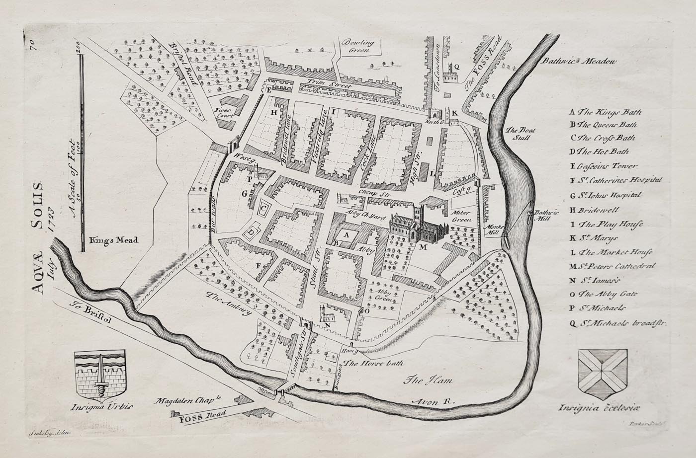
Title: Bath - Aquae Solis by William Stukeley
Publication: Itinerarium Curiosum or, An account of the antiquitys and remarkable curiositys in nature or art, observ'd in travels thro' Great Brittan
Date: July 1723
Description: Early 18th century map of Bath by William Stukeley engraved by Parker. Key of references and two vignettes of coats of arms. Bath Abbey featured to centre in 3D.
Condition: good paper and imprint, uncoloured, collection stamp verso. Very scarce.
Image size: 180 x 280mm, 7 x 11" approx.
SOLD
Order No. 4188
Click here for framing suggestions
Early 18th century map of Bath by William Stukeley
William Stukeley FRS FSA (7 November 1687 – 3 March 1765) An English antiquarian, physician and Anglican clergyman. A significant influence on the later development of archaeology, he pioneered the scholarly investigation of the prehistoric monuments of Stonehenge and Avebury in Wiltshire. He published over twenty books on archaeology and other subjects during his lifetime.
Mon - Closed
Tues-Fri 10am-1.30pm, 2.30-5.30pm
Sat 10am-1.30pm
© Devonshire Fine Art
 Free UK Mainland Delivery*
9 Church Street
Modbury
Devon PL21 0QW. UK
01548 830872


