
Antique Map of Buckinghamshire by Robert Morden, c.1722
This original antique map of Buckinghamshire was engraved by Robert Morden and published circa 1722 in Camden's Britannia. The decorative 18th-century county map shows Buckinghamshire's towns and settlements, including Buckingham, Aylesbury, Amersham and High Wycombe. It features a decorative title cartouche and later hand colouring.
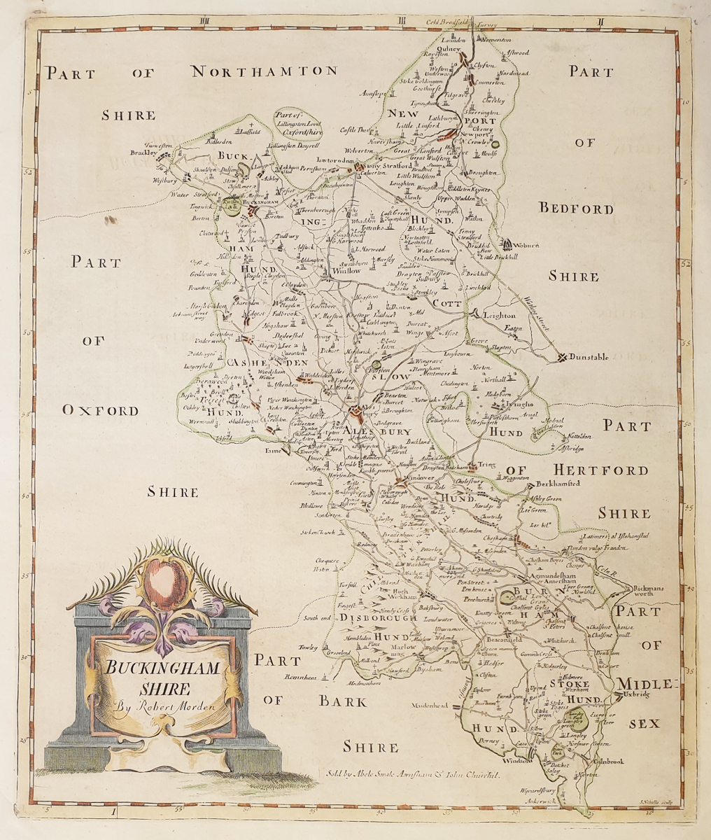
Robert Morden's Antique Map of Buckinghamshire
Mapmaker: Robert Morden
Publication: Camden's Britannia
Date: Circa 1722
Description: Decorative antique county map of Buckinghamshire, showing towns and settlements including Buckingham, Aylesbury, Amersham, High Wycombe, Beaconsfield and Winslow. The map features a decorative title cartouche.
Condition: Good margins and paper, with some age-related marks and age toning. Later hand colouring.
Image size: 425 x 360mm (16.75 x 14.2 inches approximately).
Reference: 3843
Price: £165.00
Robert Morden and his 18th-century map of Buckinghamshire
Robert Morden was one of the important English mapmakers of the late 17th and early 18th centuries. His county maps are valued for their geographical detail, decorative presentation and place in the history of British cartography.
This antique map of Buckinghamshire was published circa 1722 in Camden's Britannia. It depicts the county's towns and settlements and provides an interesting historical picture of Buckinghamshire in the early 18th century. The decorative title cartouche adds visual appeal to the map.
The map has later hand colouring and measures approximately 425 x 360mm. Its combination of historical interest and decorative appearance makes it suitable for collectors of antique maps, Buckinghamshire local history and traditional interior displays.
Browse our antique maps of Buckinghamshire or view our collection of antique maps by Robert Morden.
Frequently Asked Questions
Who made this antique map of Buckinghamshire?
The map was engraved by Robert Morden, an important English mapmaker whose county maps appeared in editions of Camden's Britannia.
When was the Buckinghamshire map published?
This map is dated circa 1722 and was published in Camden's Britannia.
What places are shown on the map?
The map includes Buckingham, Aylesbury, Amersham, High Wycombe, Beaconsfield and other Buckinghamshire settlements.
Is the map hand coloured?
Yes. The map has later hand colouring.
Can this antique map be framed?
Yes. Framing options are available. Please see our antique map framing service for further information.
Mon - Closed
Tues-Fri 10am-1.30pm, 2.30-5.30pm
Sat 10am-1.30pm
© Devonshire Fine Art
 Free UK Mainland Delivery*
9 Church Street
Modbury
Devon PL21 0QW. UK
01548 830872


