
Antique Map of the British Islands by Mercator and Hondius, c.1628
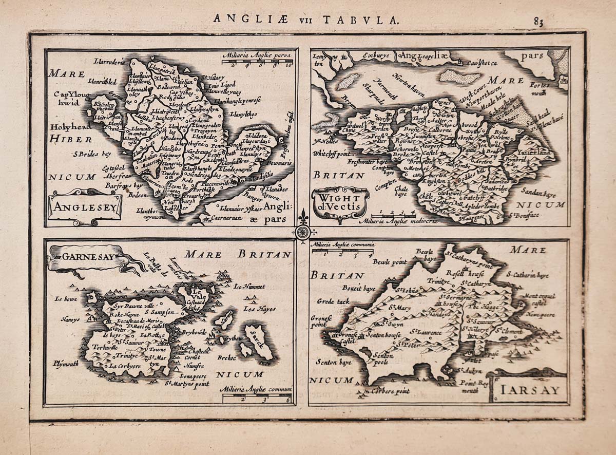
17th-century antique map of the British Islands
This attractive miniature antique map depicts the British Islands and was produced during the 17th century. The map is associated with the renowned cartographers Gerardus Mercator and Jodocus Hondius, whose work helped shape the development of European mapmaking.
The map depicts several of the British islands, including Anglesey, the Isle of Wight, Jersey, Guernsey and Sark. It also includes the Isle of Man, Orkney and Shetland. Decorative details include a compass rose and a mileage scale.
This is an interesting historical map for collectors of early maps of Britain, the British Isles and the Channel Islands. Its small format makes it particularly suitable for display or framing.
Map details
- Cartographers: Gerardus Mercator and Jodocus Hondius (attribution to be verified)
- Publication: To be confirmed
- Date: To be confirmed
- Subject: British Islands
- Condition: Uncoloured, with a bold imprint and some age discolouration. Latin text on the reverse.
- Image size: 137 x 197mm (approximately 5.5 x 7.75 inches)
- Price: £95.00
- Order number: 4289
Click here for British Islands antique map framing suggestions
Original antique map of the British Islands
An interesting early map depicting the British Islands, including the Channel Islands, Isle of Man and northern islands.
Explore more of our antique maps of the British Isles, including historic maps of the Channel Islands, Scotland and Wales.
Who were Gerardus Mercator and Jodocus Hondius
Gerardus Mercator (1512–1594) and Jodocus Hondius (1563–1612) were two influential Flemish cartographers whose work helped shape the development of European mapmaking during the 16th and early 17th centuries. Mercator was renowned for his geographical knowledge and innovative map projection, while Hondius became celebrated for his skill as an engraver and map publisher.
Gerardus Mercator (1512–1594)
Born Geert De Kremer in Flanders, Gerardus Mercator was a distinguished mathematician, geographer, globe maker and cartographer. He is best known for developing the Mercator projection, first published in 1569. This revolutionary system represented lines of constant compass bearing as straight lines, making it particularly valuable for marine navigation.
Mercator also produced globes and a major collection of maps. His ambition to create a comprehensive account of the world helped establish the foundations for the modern atlas.
Jodocus Hondius (1563–1612)
Jodocus Hondius was a Flemish engraver, cartographer and publisher. Having left the Low Countries during a period of religious persecution, he spent time in London before settling in Amsterdam, where he established a successful mapmaking and publishing business.
In 1604, Hondius acquired the copper printing plates of Mercator's Atlas. Two years later, he published a new edition of the work, incorporating additional maps of his own. This became known as the Mercator-Hondius Atlas and helped preserve and extend Mercator's cartographic legacy.
The Mercator-Hondius partnership
The combination of Mercator's geographical scholarship and Hondius's engraving and publishing expertise produced one of the most influential atlases of the period. Their work helped bring detailed and increasingly sophisticated maps to a wider European audience, leaving a lasting contribution to the history of cartography.
Frequently Asked Questions
Who were Gerardus Mercator and Jodocus Hondius?
Gerardus Mercator was a celebrated 16th-century cartographer, while Jodocus Hondius was a Dutch engraver and publisher who helped popularise Mercator's geographical work.
Which islands are shown on this antique map?
The map includes the Isle of Wight, Jersey, Guernsey, Sark, the Isle of Man, Orkney and Shetland, as well as Anglesey.
Is this an original antique map?
Yes, this item is offered as an original antique map. Please refer to the product description for its condition and publication details.
Can this antique map be framed?
Yes. We offer framing suggestions for this map. See our antique map framing service.
Mon - Closed
Tues-Fri 10am-1.30pm, 2.30-5.30pm
Sat 10am-1.30pm
© Devonshire Fine Art
 Free UK Mainland Delivery*
9 Church Street
Modbury
Devon PL21 0QW. UK
01548 830872


