
Antique Map of the British Islands by Richard Blome, circa 1681
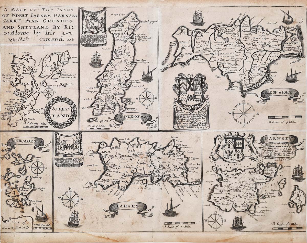
Original 17th-century antique map of the British Islands by Richard Blome
This attractive antique map of the British Islands was produced by Richard Blome and published circa 1681 in Speed's Maps Epitomiz'd. It brings together a series of detailed island maps, illustrating several important island groups around the British Isles.
The map includes the Isle of Wight, Jersey, Guernsey, Sark, the Isle of Man, Orkney and Shetland. Its decorative presentation includes ship vignettes, compass roses and individual mileage scales.
The map is an interesting example of 17th-century British cartography, combining geographical information with decorative engraving. It would appeal to collectors of early British maps, Channel Islands maps and historic island maps.
Map details
- Publisher: Richard Blome
- Title: A Mapp of the Isles of Wight, Jarsey, Garnsey, Sarke, Man, Orcades and Shetland
- Publication: Speed's Maps Epitomiz'd
- Date: Circa 1681
- Subject: British Islands and surrounding islands
- Image size: 275 x 362mm (approximately 10.75 x 14.25 inches)
- Condition: Bold imprint and folding copy as published, with some age discolouration and water staining. Side margins have been cropped to the border, with minor loss. Priced accordingly.
Richard Blome and 17th-century mapmaking
Richard Blome (1635–1705) was an English map publisher and cartographer active during the late 17th century. He produced a number of geographical and historical publications, including atlases and county maps, drawing on earlier cartographic sources.
His Speed's Maps Epitomiz'd was published in the late 17th century and brought together maps covering different parts of the British Isles and the wider world. Blome's publications are of interest to collectors of early English maps and antiquarian cartography.
Explore more antique maps of the British Isles
Browse our collection of antique maps of the British Isles, including historic maps of the Channel Islands, the Isle of Man, the Isle of Wight and Scotland.
Frequently Asked Questions
Who produced this antique map of the British Islands?
The map was published by Richard Blome, an English map publisher and cartographer active during the 17th century.
What islands are shown on the map?
The map includes the Isle of Wight, Jersey, Guernsey, Sark, the Isle of Man, Orkney and Shetland.
When was Richard Blome's map published?
This example is dated circa 1681 and is associated with Speed's Maps Epitomiz'd.
Can this antique map be framed?
We offer framing suggestions for antique maps. Please see our antique map framing service for further information.
Mon - Closed
Tues-Fri 10am-1.30pm, 2.30-5.30pm
Sat 10am-1.30pm
© Devonshire Fine Art
 Free UK Mainland Delivery*
9 Church Street
Modbury
Devon PL21 0QW. UK
01548 830872


