
Antique Map of Buckinghamshire by Thomas Jenner, 1643
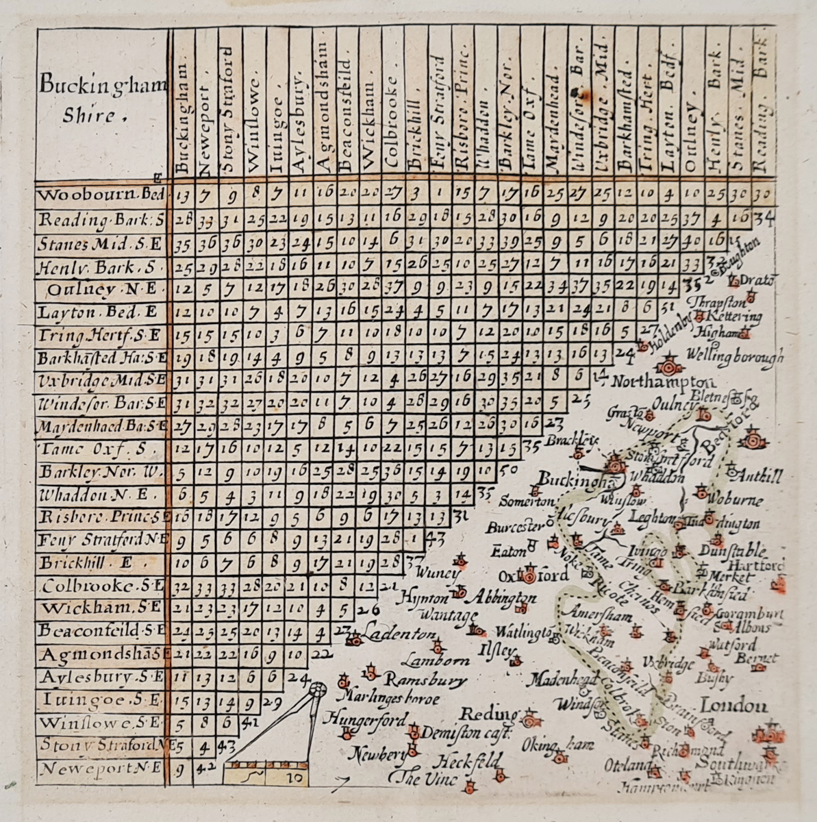
Thomas Jenner and the 1643 Map of Buckinghamshire
Thomas Jenner (fl. 1618–1673) was a print seller and publisher associated with several important cartographic works of 17th-century England. These included a reissue of Matthew Simmons's A Direction for the English Traviller and a map of England and Wales known as the Quartermaster's Map.
In 1643, Jenner issued a revised version of the maps originally published by Simmons in 1635–1636. The revised maps were drawn at twice the original scale, allowing place names to be shown more fully. John Norden's distance table was retained, although parts of the border and London mileage line were erased.
The timing of these revisions suggests that the maps may have been produced in response to the needs of armies during the English Civil War. This Buckinghamshire map offers a fascinating example of early county mapping, combining geographical information with practical details for travellers.
Browse our antique maps of Buckinghamshire to discover other historical maps of the county.
Condition: Good imprint, with later hand colouring and some old tape marks to the margins.
Image size: 100 × 100 mm (approximately 4 × 4 inches).
Price: £75.00
Reference: 4064
Collecting 17th-Century Maps of Buckinghamshire
Published in 1643, this antique map of Buckinghamshire by Thomas Jenner is an example of early English county mapping. Its association with A Direction for the English Traviller and the period of the English Civil War adds historical interest for collectors of antique maps and Buckinghamshire history.
The map has later hand colouring and some old tape marks to the margins. Please consult the product description and image for details of its condition.
Explore our antique maps of Buckinghamshire or browse our collection of antique maps of Britain.
Frequently Asked Questions
Who published the 1643 map of Buckinghamshire?
The map was issued by Thomas Jenner in 1643 as part of A Direction for the English Traviller.
What makes this Buckinghamshire map historically interesting?
Dating from the 17th century, the map was published during the English Civil War. It includes place names, a mileage chart associated with John Norden, and a compass and scale.
What is the condition of the map?
The map has a good imprint and later hand colouring, with some old tape marks to the margins. Please refer to the description and image when assessing its condition.
Mon - Closed
Tues-Fri 10am-1.30pm, 2.30-5.30pm
Sat 10am-1.30pm
© Devonshire Fine Art
 Free UK Mainland Delivery*
9 Church Street
Modbury
Devon PL21 0QW. UK
01548 830872


