
Antique Map of Buckinghamshire, 1610 – William Hole after Christopher Saxton
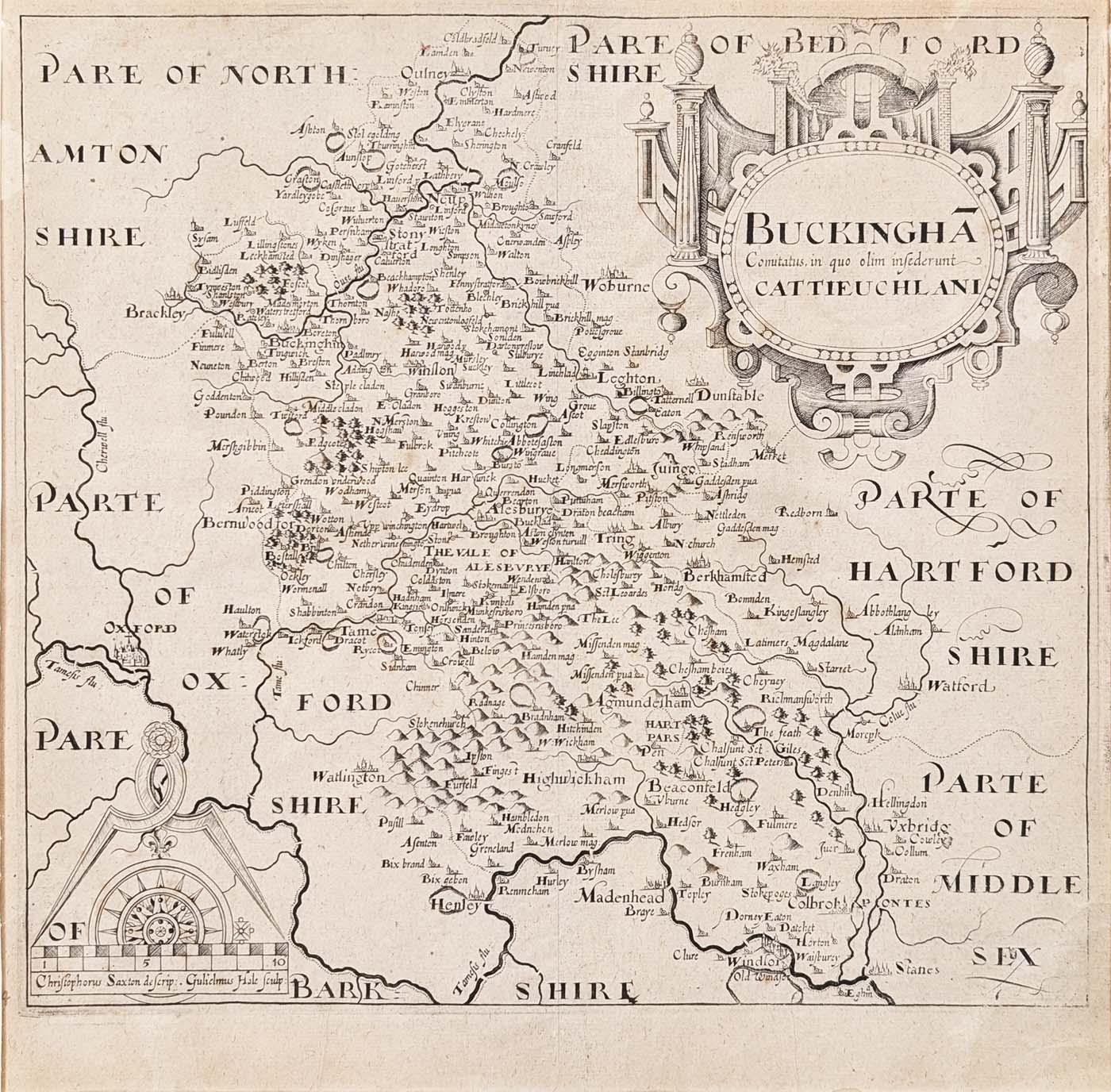
Discover this early 17th-century antique map of Buckinghamshire, dated 1610 and attributed to William Hole after Christopher Saxton. Published in connection with William Camden's Britannia, the map features a decorative coat of arms, compass rose and mileage scale. Price: £190.00.
Map Details
- County: Buckinghamshire, England
- Date: 1610
- Engraver attribution: William Hole
- Cartographic source: Christopher Saxton
- Publication: William Camden's Britannia
- Features: Coat of arms, compass rose and mileage scale
- Condition: Some age toning, reasonable margins and a good, bold imprint
- Image size: 295 × 335 mm (approximately 11.6 × 13.2 inches)
- Price: £190.00
- Order number: 3842
A 1610 Antique Map of Buckinghamshire
This antique map of Buckinghamshire dates from 1610 and was published in William Camden's Britannia. The map is attributed to the engraver William Hole and is based on Christopher Saxton's earlier mapping of the county.
This early 17th-century county map provides a historical view of Buckinghamshire and is distinguished by its decorative coat of arms, compass rose and mileage scale. It offers an interesting example of the printed county maps produced during the early modern period.
The map has some age toning, reasonable margins and a good, bold imprint. The verso has no text, as described for this example.
Browse our antique maps of Buckinghamshire to discover other historical maps of the county, or explore our antique map framing options.
Frequently Asked Questions
Who engraved this 1610 map of Buckinghamshire?
The map is attributed to William Hole and is based on Christopher Saxton's earlier mapping of Buckinghamshire.
Which publication does the map come from?
This map was published in William Camden's Britannia, the historical and geographical work describing Britain and Ireland.
What decorative features does the map have?
The map features a coat of arms, a compass rose and a mileage scale.
What is the condition of the map?
This example has some age toning, reasonable margins and a good, bold imprint.
Can the map be framed?
Yes. Explore our antique map framing options for further information.
Mon - Closed
Tues-Fri 10am-1.30pm, 2.30-5.30pm
Sat 10am-1.30pm
© Devonshire Fine Art
 Free UK Mainland Delivery*
9 Church Street
Modbury
Devon PL21 0QW. UK
01548 830872


