
Antique Map of Cambridgeshire by Robert Morden, c.1695
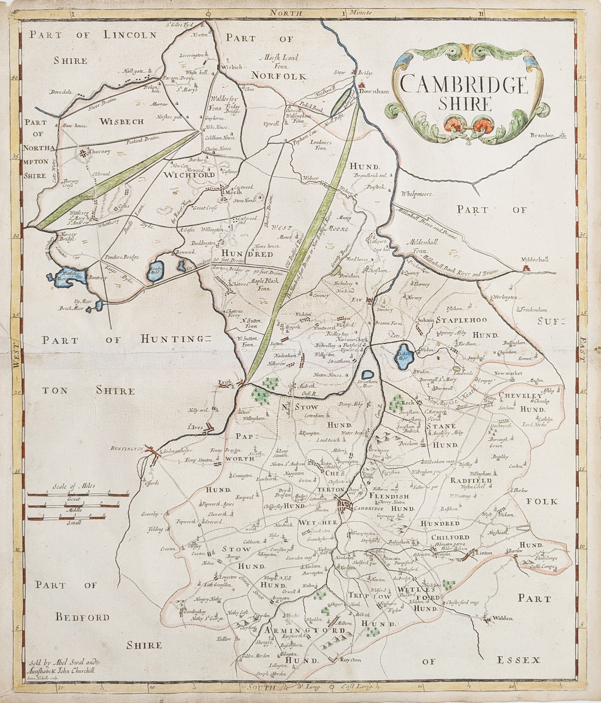
Map Details
- Title: Cambridgeshire
- Mapmaker: Robert Morden
- Publication: Camden's Britannia
- Date: Circa 1695
- Features: Decorative title cartouche and later hand colouring
- Condition: Good image; folding copy with some creases and age toning
- Image size: 425 × 360 mm (approximately 16¾ × 14 inches)
- Price: £115.00
- Order number: 4661
17th-Century Antique Map of Cambridgeshire by Robert Morden
This antique map of Cambridgeshire was produced by Robert Morden, one of the best-known English mapmakers of the late 17th century. Dated circa 1695 and published in Camden's Britannia, it offers a historical depiction of the county from a period when printed county maps were becoming increasingly important to geographical study and collecting.
The map features a decorative title cartouche and later hand colouring. Measuring approximately 425 × 360 mm (16¾ × 14 inches), it is a substantial example of an early county map and would be of interest to collectors of antique British maps, Cambridgeshire history and historic cartography.
The condition is described as a good image, with some creasing and age toning. This is a folding copy, and the map has later hand colouring. Please examine the product image and contact us if you would like further details about its condition or appearance.
Buying This Antique Map of Cambridgeshire
The map is offered for £115.00. Framing options are available, including a choice of frame styles and glazing. Please check the available options and additional charges before ordering.
Explore more examples in our collection of antique maps of Cambridgeshire, or browse our collection of antique maps by Robert Morden.
Mon - Closed
Tues-Fri 10am-1.30pm, 2.30-5.30pm
Sat 10am-1.30pm
© Devonshire Fine Art
 Free UK Mainland Delivery*
9 Church Street
Modbury
Devon PL21 0QW. UK
01548 830872


