
Antique Map of Cheshire by Creighton and Walker, c.1831
Back to Cheshire
This original antique map of Cheshire dates from circa 1831 and was produced by Robert Creighton and James and Charles Walker for Lewis's Topographical Dictionary. The detailed 19th-century county map shows historic Cheshire towns and settlements, including Chester, Stockport, Macclesfield, Northwich, Nantwich and Knutsford. This example has later hand colouring and retains its original published folds.
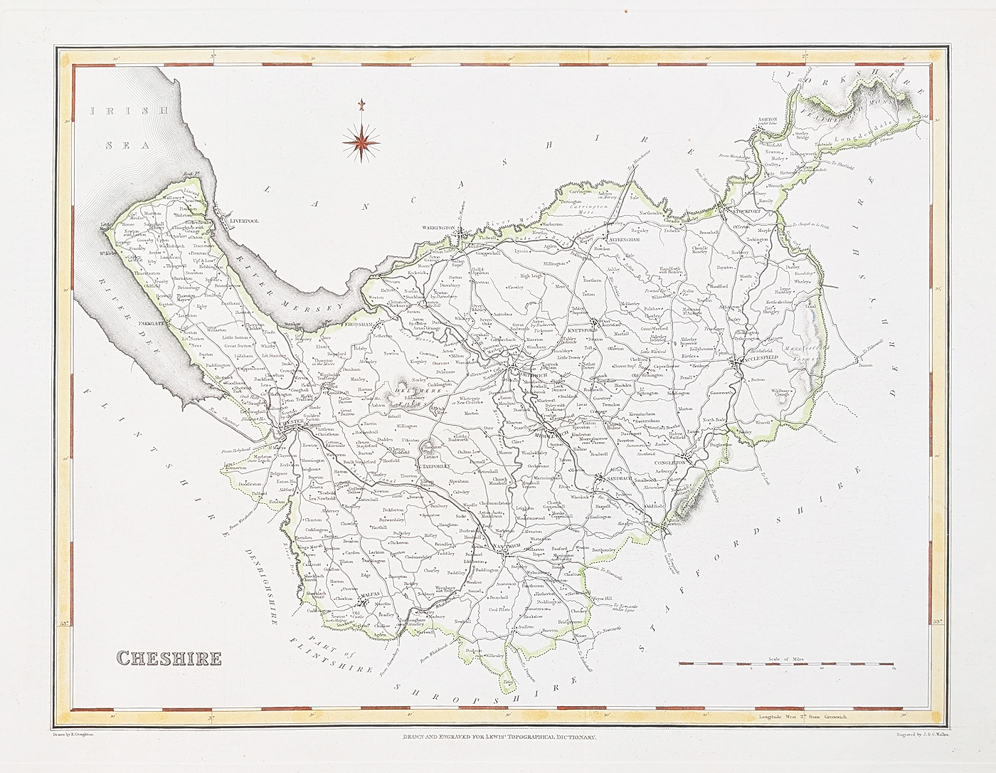
Details of the Antique Cheshire Map
Title: Cheshire
Mapmakers: Robert Creighton and James and Charles Walker
Publication: Lewis's Topographical Dictionary
Date: Circa 1831
Description: Detailed 19th-century county map of Cheshire, showing Northwich, Macclesfield, Middlewich, Malpas, Chester, Knutsford, Nantwich, Altrincham, Stockport and Congleton.
Condition: Good paper, bold imprint and later hand colouring. Folding copy as published, with minor age-related blemishes. Double-page map.
Map size: 300 x 335mm (approximately 12 x 13.2 inches)
Price: £39.95
Reference: 4823
Cheshire in the 19th century
This antique map of Cheshire was published around 1831 in Lewis's Topographical Dictionary, a geographical and topographical reference work describing towns, settlements and places throughout Britain. It was produced by Robert Creighton and the mapmaking firm of James and Charles Walker.
The map provides a historical picture of Cheshire during the early 19th century, showing its towns and settlements, including Chester, Stockport, Macclesfield, Northwich, Nantwich, Knutsford and Congleton. Its county detail makes it interesting to collectors of antique maps and those researching the history of Cheshire and its towns.
This example retains its original published folds and has later hand colouring. The bold printed detail and attractive county presentation make it an appealing original map for display or for a collection of British county maps.
Browse more antique maps of Cheshire, explore our collection of antique maps of the British Isles, or find out more about our antique map framing service.
Frequently Asked Questions
Who made this antique map of Cheshire?
The map was produced by Robert Creighton and James and Charles Walker.
When was the Cheshire map published?
It dates from approximately 1831 and was published in Lewis's Topographical Dictionary.
Which Cheshire towns are shown?
The map includes Chester, Stockport, Macclesfield, Northwich, Middlewich, Nantwich, Knutsford and Congleton, among other places.
Is the map hand coloured?
Yes. This example has later hand colouring.
Can this antique map be framed?
Yes. Framing options are available. See our antique map framing service for further details.
Mon - Closed
Tues-Fri 10am-1.30pm, 2.30-5.30pm
Sat 10am-1.30pm
© Devonshire Fine Art
 Free UK Mainland Delivery*
9 Church Street
Modbury
Devon PL21 0QW. UK
01548 830872


