
Antique Map of Cheshire by Thomas Jenner, 1643
View all antique maps of Cheshire
This original antique map of Cheshire was published by Thomas Jenner in 1643 in A Direction for the English Traviller. Dating from the mid-17th century, it is an interesting early printed map of the county, produced during the English Civil War. The map includes historic Cheshire towns including Chester, Macclesfield and Nantwich, together with a mileage table associated with John Norden. Later hand colouring adds to its decorative appeal.
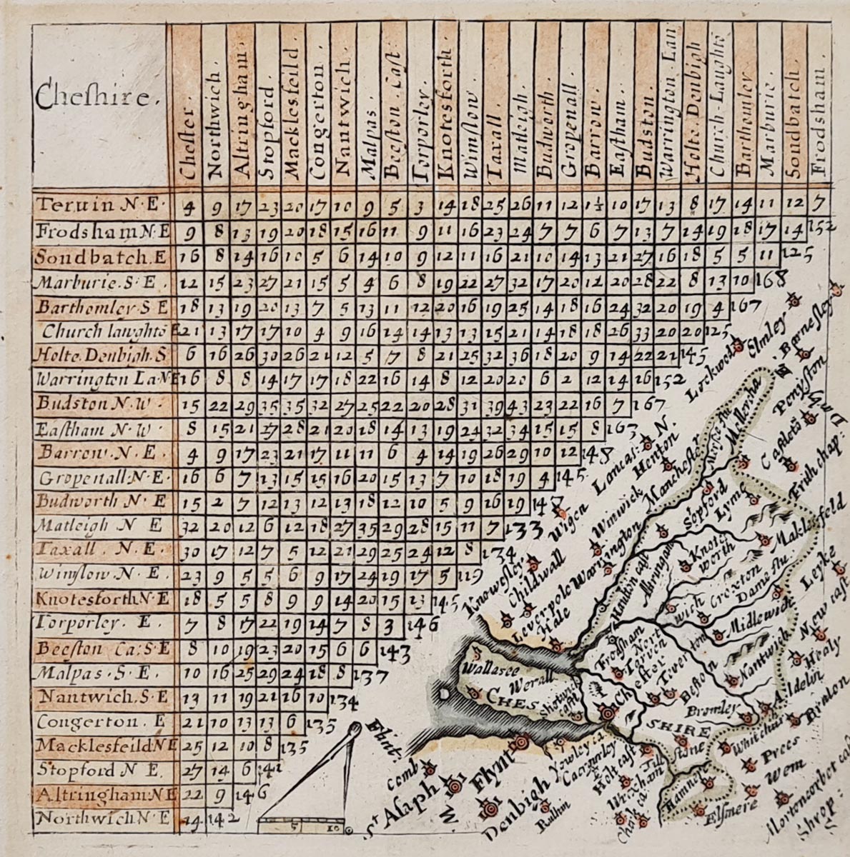
Details of the 1643 Cheshire Antique Map
Map title: Chefhire (original spelling on the map)
Mapmaker: Thomas Jenner
Publication: A Direction for the English Traviller
Date: 1643
Description: A mid-17th-century county map of Cheshire, published during the English Civil War. It includes John Norden's mileage table and historic place names including Chester, Macclesfield and Nantwich. A compass and scale appear towards the bottom centre.
Condition: Good imprint, with later hand colouring and some old tape marks to the margins.
Image size: 100 x 100mm (approximately 4 x 4 inches).
Price: £75.00
Reference number: 4065
Thomas Jenner and his 1643 Map of Cheshire
Thomas Jenner (fl. 1618–1673) was an English print seller and publisher whose cartographic publications are particularly interesting to collectors of early British maps.
In 1643, Jenner reissued Matthew Simmons' A Direction for the English Traviller, first published in 1635–36. The revised edition contained county maps at twice the original scale, with place names shown in greater detail. John Norden's mileage tables were retained, although some of the original decorative and geographical features were altered.
The publication appeared during the English Civil War, when accurate information about routes and distances would have been particularly useful to travellers and military forces. Jenner's 1643 Cheshire map is therefore an interesting example of early English commercial cartography from this turbulent period.
Today, surviving maps from this publication are of interest to collectors of 17th-century English maps and the history of British cartography.
Explore More Antique Maps
Discover our collection of antique maps of Cheshire, including historic county maps from the 17th, 18th and 19th centuries.
You can also browse our collection of antique maps of Britain and discover more early maps of England.
For other historic town plans and city maps, visit our collection of antique town maps.
Frequently Asked Questions
Who made the 1643 antique map of Cheshire?
The map was published by Thomas Jenner in 1643 as part of A Direction for the English Traviller, a collection of early English county maps.
How old is Thomas Jenner's map of Cheshire?
The map dates from 1643, making it approximately 383 years old in 2026. It is an interesting example of 17th-century English cartography.
What towns are shown on the map?
The map includes historic Cheshire place names such as Chester, Macclesfield and Nantwich.
What is the condition of the map?
The map has a good imprint and later hand colouring. There are some old tape marks to the margins.
Can this antique Cheshire map be framed?
Yes. We offer framing suggestions for antique maps. Please see our antique map framing service for further information.
Mon - Closed
Tues-Fri 10am-1.30pm, 2.30-5.30pm
Sat 10am-1.30pm
© Devonshire Fine Art
 Free UK Mainland Delivery*
9 Church Street
Modbury
Devon PL21 0QW. UK
01548 830872


