
Antique Map of Cornwall by Joan Blaeu, circa 1645
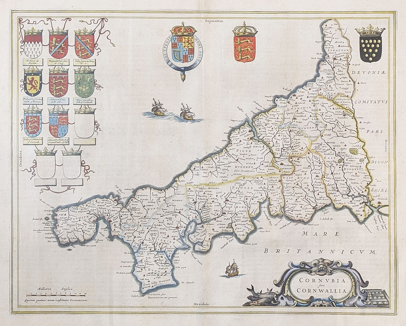
Original 17th-century antique map of Cornwall by Joan Blaeu
This attractive antique map of Cornwall was produced by the celebrated Dutch cartographer Joan Blaeu, circa 1645, during the golden age of Dutch mapmaking. It was published in Theatrum Orbis Terrarum, Sive Atlas Novus, one of the important atlases of the 17th century.
Entitled Cornubia five Cornwallia, the map depicts the historic county of Cornwall and is an excellent example of Blaeu's decorative cartographic style. Its Latin title, elegant presentation and later hand colouring make it particularly appealing to collectors of antique maps of Cornwall and historic British county maps.
The map measures approximately 380 x 515mm (15 x 20.25 inches). It retains its original printed Latin text on the reverse and is described as a folding copy as published, with good paper and imprint, good margins and minor age discolouration.
Price: £495.00
An interesting and decorative 17th-century antique map for collectors of Cornwall, British history and early European cartography, produced during the English Civil War.
Order No. 4766
Click here for framing suggestions
About this 17th-century antique map of Cornwall
Joan Blaeu's map of Cornwall is a fine example of Dutch cartography from the mid-17th century. Produced circa 1645, it comes from his important atlas, Theatrum Orbis Terrarum, Sive Atlas Novus, published during a period when Dutch mapmakers were renowned for the quality, accuracy and decorative appeal of their work.
The map is titled Cornubia five Cornwallia, the Latin name for Cornwall. It provides a historical representation of the county as it was understood in the 17th century. Its decorative presentation and later hand colouring make it an attractive piece for collectors of early British maps and anyone with an interest in the history of Cornwall.
Joan Blaeu and his antique maps
Joan Blaeu (1596–1673) was one of the leading Dutch cartographers and publishers of the 17th century. He continued the work of his father, Willem Blaeu, and became particularly celebrated for his beautifully produced atlases. Blaeu maps are sought after for their historical importance, fine engraving and decorative qualities.
You can discover more examples in our collection of antique maps by Joan Blaeu.
Collecting antique maps of Cornwall
Antique maps of Cornwall are popular with collectors, local historians and people with a personal connection to the county. Early maps are especially interesting because they show how the landscape, settlements and geographical knowledge of Cornwall were represented centuries ago.
Browse our wider selection of antique maps of Cornwall to see other historical maps of the county, or explore our collection of antique maps of the British Isles.
Framing your antique map
A 17th-century map such as this can make an attractive display piece. We offer a map framing service to help you choose a suitable frame and presentation for your antique map.
Mon - Closed
Tues-Fri 10am-1.30pm, 2.30-5.30pm
Sat 10am-1.30pm
© Devonshire Fine Art
 Free UK Mainland Delivery*
9 Church Street
Modbury
Devon PL21 0QW. UK
01548 830872


