
Antique Map of Cornwall by Joan Blaeu, c.1645–48
Back to: Cornwall | Joan Blaeu maps
This original antique map of Cornwall, titled Cornubia sive Cornwallia, was produced by the Dutch cartographer Joan Blaeu circa 1645–48 and published in Le Theatre du Monde ou Nouvel Atlas. Dating from the 17th century, this decorative map depicts the historic county of Cornwall and features later hand colouring, fine engraved detail and French text on the reverse. An attractive example of Blaeu's celebrated atlas mapping, this genuine antique map is available to buy from Antique Maps Online.
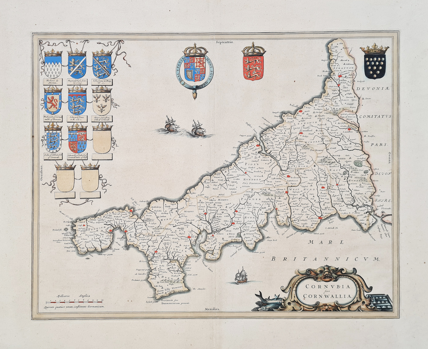
Details of the Original Blaeu Cornwall Map
Map title: Cornubia sive Cornwallia
Cartographer: Joan Blaeu
Publication: Le Theatre du Monde ou Nouvel Atlas
Date: circa 1645–48
Description: Decorative 17th-century map of Cornwall, produced during the period of the English Civil War. Possibly a second edition.
Condition: Paper and imprint good, French text on verso, folding copy as published, minor age discolouration, good margins and later hand colouring.
Image size: 380 × 515mm (approximately 15 × 20.25 inches).
Price: £485.00
Reference: 4156
Joan Blaeu's 17th-century Map of Cornwall
Joan Blaeu was a leading Dutch cartographer and publisher of the 17th century. His atlases are well known for their detailed maps, decorative presentation and fine engraving. This map of Cornwall, dated circa 1645–48, is an example of the county mapping produced during this important period in the history of European cartography.
Cornwall in the 17th century
Cornwall has a distinctive geographical character, with its long coastline, historic fishing communities, market towns and mining districts. Early maps of the county are valuable records of how its geography was represented before the major changes brought about by later surveying and mapmaking.
Published in Le Theatre du Monde
The map appeared in Le Theatre du Monde ou Nouvel Atlas, one of the atlas publications associated with Joan Blaeu. Its later hand colouring gives it additional decorative appeal, while the French text on the reverse reflects the publication in which it appeared.
This original antique map is offered for £485.00. Please see the product details above for its condition, dimensions and framing options.
You can explore more examples in our collection of antique maps of Cornwall or browse our antique maps by Joan Blaeu.
Explore more examples of antique maps of Britain, including historic county maps from the 17th, 18th and 19th centuries.
Frequently Asked Questions
Who made this antique map of Cornwall?
The map was produced by the Dutch cartographer Joan Blaeu, a prominent 17th-century mapmaker and atlas publisher.
When was the Cornwall map published?
It is dated circa 1645–48 and is associated with Le Theatre du Monde ou Nouvel Atlas.
Is the map hand coloured?
Yes. This example has later hand colouring, rather than colouring that can confidently be described as original to the date of publication.
Can this antique map be framed?
Yes. We offer framing suggestions for antique maps. Please visit our antique map framing page for further information.
What is the historical significance of this map?
Produced in the mid-17th century, this map provides a historical representation of Cornwall during an important period in British history. It is also an example of the detailed county mapping associated with Joan Blaeu's celebrated atlas publications.
Mon - Closed
Tues-Fri 10am-1.30pm, 2.30-5.30pm
Sat 10am-1.30pm
© Devonshire Fine Art
 Free UK Mainland Delivery*
9 Church Street
Modbury
Devon PL21 0QW. UK
01548 830872


