
Antique Map of Cumberland by Thomas Jenner, 1657
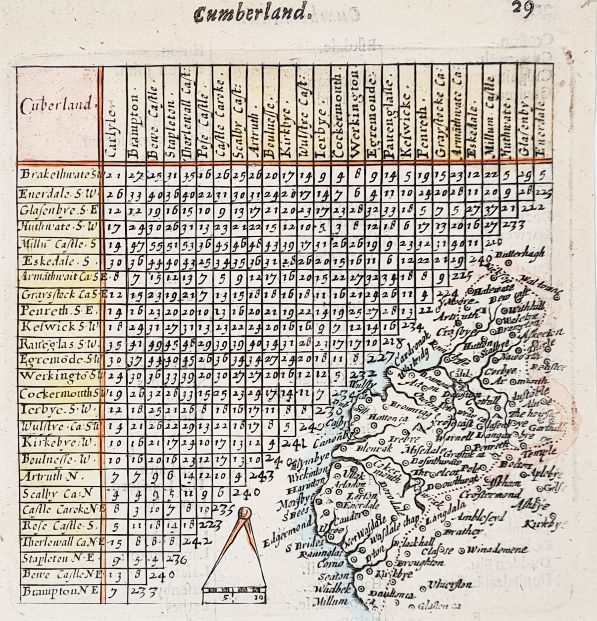
Thomas Jenner's Antique Map of Cumberland, 1657
This scarce antique map of Cumberland was published by Thomas Jenner in 1657, during the mid-17th century. It appeared in A Direction for the English Traviller, an important early English travel guide incorporating county maps and mileage information.
The map provides a fascinating picture of historic Cumberland, with place names including Cockermouth, Workington and Keswick. It incorporates a version of John Norden's mileage chart, helping travellers understand distances between places. A compass and scale appear towards the bottom centre of the map.
The original map has the title "Cumberland" and page number 29 in the upper margin. These details are useful features when identifying the map and its original publication.
Thomas Jenner (fl. 1618–1673) was an English print seller and publisher. He is associated with the publication of A Direction for the English Traviller and the map of England and Wales known as the Quartermaster's Map. The travel guide's maps were developed from earlier work by Matthew Simmons and retained Norden's distance information.
Condition and Dimensions
- Date: 1657
- Mapmaker and publisher: Thomas Jenner
- Publication: A Direction for the English Traviller
- Subject: Cumberland, historic county of England
- Condition: Good imprint, later hand colouring and some old tape marks to the margins
- Image size: 110 x 100mm (approximately 4.3 x 3.9 inches)
- Order number: 4067
- Price: £65.00
This small 17th-century map is an interesting original item for collectors of early English county maps, Cumberland history and the work of Thomas Jenner.
A Scarce Original Cumberland Map from 1657
Published by Thomas Jenner in the mid-17th century, this scarce map of Cumberland is an interesting example of early English county mapping. Its appearance in A Direction for the English Traviller connects it with the development of printed travel guides and the growing importance of geographical information in 17th-century England.
With its original printed details and later hand colouring, this small map offers an attractive historical record of Cumberland. It is particularly suitable for collectors of early British maps, 17th-century cartography and the work of Thomas Jenner.
Explore our collection of antique maps of Cumberland for further examples of historic county maps.
Frequently Asked Questions
Who published the 1657 map of Cumberland?
The map was published by Thomas Jenner in 1657 in the travel guide A Direction for the English Traviller.
What places are shown on this antique map?
The map includes historic Cumberland place names such as Cockermouth, Workington and Keswick.
Is this an original 17th-century map?
Yes. This is an original map published in 1657, with later hand colouring. It is not a modern reproduction.
Can the map be framed?
Yes. Please see our antique map framing service for framing suggestions.
Mon - Closed
Tues-Fri 10am-1.30pm, 2.30-5.30pm
Sat 10am-1.30pm
© Devonshire Fine Art
 Free UK Mainland Delivery*
9 Church Street
Modbury
Devon PL21 0QW. UK
01548 830872


