
Antique Map of Devonshire by John and Charles Walker, 1836
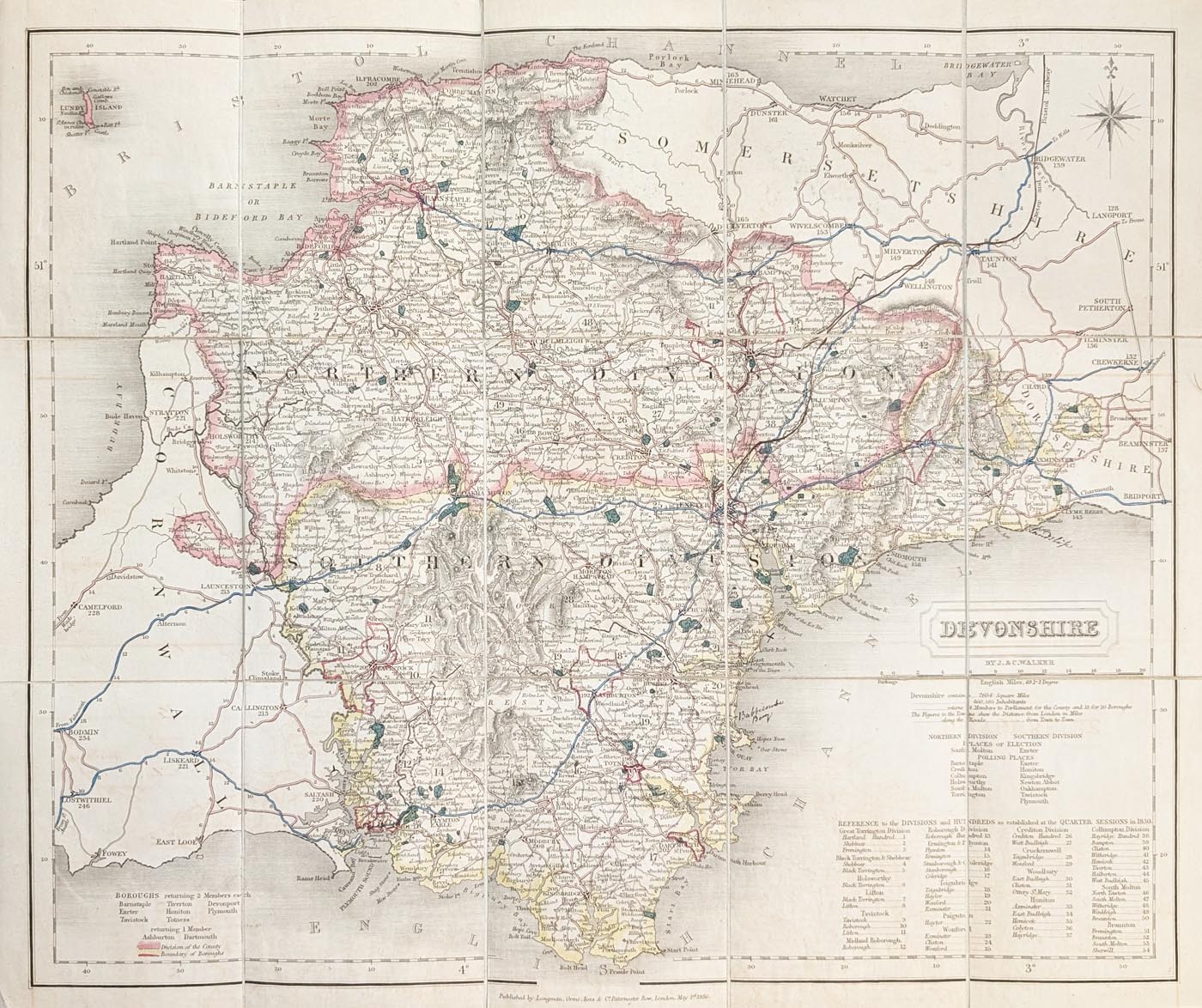
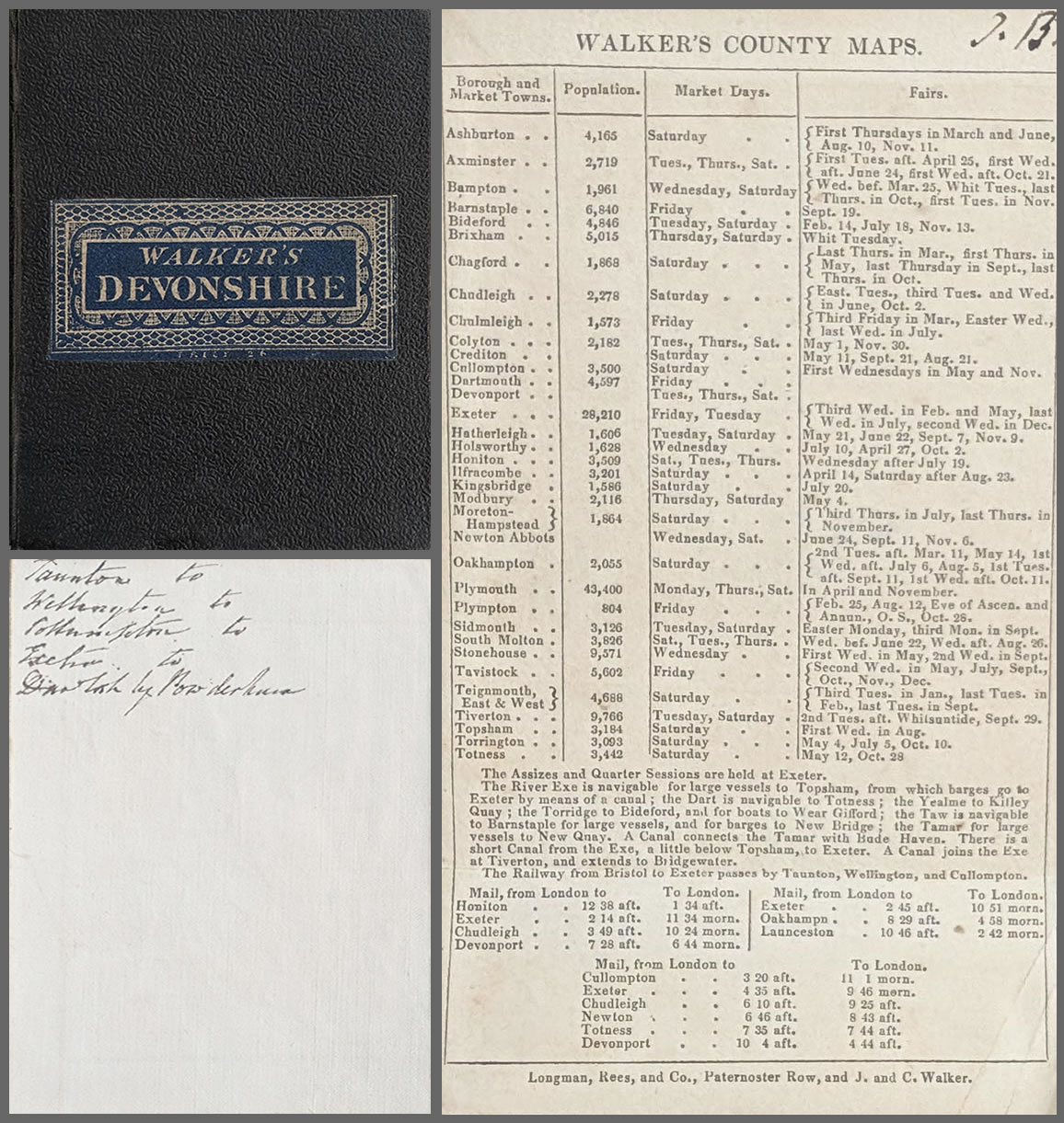
Antique Map of Devonshire, 1836
Purchase this antique map
£60.00
Published by Longman, Orme, Rees & Co., Paternoster Row, London, May 1st 1836
Original 19th-century county map of Devonshire, hand coloured and laid on linen as issued.
Order number: 5048
Free UK Mainland Delivery
Antique map framing suggestions
About this Antique Folding Map of Devonshire, 1836
This original antique map of Devonshire was published on 1 May 1836 by Longman, Orme, Rees & Co. of Paternoster Row, London. Produced by the respected mapmakers John and Charles Walker, it is an attractive example of early 19th-century British county cartography.
The map is hand coloured and laid on linen as originally issued, in a practical folding format. It shows Devonshire in considerable detail and is accompanied by lists of towns in the North and South Divisions, together with a table of the county's hundreds.
Dating from the reign of William IV, this historic map offers an interesting record of Devon before the major changes brought about by the Victorian railway age. Its original linen-backed folding format and attractive colouring make it an appealing piece for collectors of antique maps and those with an interest in the history of Devon.
Antique Map Details
- Map: Devonshire
- Cartographers: John and Charles Walker
- Date: 1836
- Publisher: Longman, Orme, Rees & Co., London
- Publication: Walker's County Map (box set)
- Publication date: 1 May 1836
- Colouring: Original hand colouring
- Dimensions: 387 x 327mm (approximately)
- Format: Folding map laid on linen
- Condition: Original folding map, with good paper, clear printing and original imprint
- Order number: 5048
- Price: £60.00
John and Charles Walker – 19th-Century Mapmakers
John and Charles Walker were prominent British engravers, cartographers and map publishers during the 19th century. Their work is particularly associated with the production of detailed county maps, atlases and geographical publications.
The brothers were sons of John Walker Snr, who had an important career in hydrography, working with Alexander Dalrymple and subsequently the Admiralty. John Walker the younger also became hydrographer to the East India Company in 1836.
John and Charles Walker produced maps for a variety of publishers and cartographers, as well as undertaking their own publishing work. Their maps appeared in numerous geographical publications, including Lewis's Topographical Dictionary of England, which contained a substantial collection of county maps.
Their work is valued by collectors for its clear engraving, geographical detail and attractive presentation. This 1836 map of Devonshire is a good example of their contribution to British county cartography.
Explore more antique maps by John and Charles Walker, or browse our collection of antique maps of Devon.
Frequently Asked Questions
Who made the 1836 antique map of Devon?
The map was produced by John and Charles Walker and published by Longman, Orme, Rees & Co. in London on 1 May 1836.
Is this an original antique map?
Yes. This is an original 19th-century map dating from 1836, not a modern reproduction.
Is the map hand coloured?
Yes. The map has original hand colouring and is laid on linen as originally issued.
What are the dimensions of the map?
The map measures approximately 387 x 327mm.
Can the antique map be framed?
Yes. We offer antique map framing suggestions. Please contact us if you would like advice on suitable framing for this folding map.
Mon - Closed
Tues-Fri 10am-1.30pm, 2.30-5.30pm
Sat 10am-1.30pm
© Devonshire Fine Art
 Free UK Mainland Delivery*
9 Church Street
Modbury
Devon PL21 0QW. UK
01548 830872


