
Antique Map of Devonshire by Joan Blaeu, c.1648
An original Blaeu map of Devonshire dating from around 1648, with decorative coats of arms, later hand colouring and Latin text on the reverse.
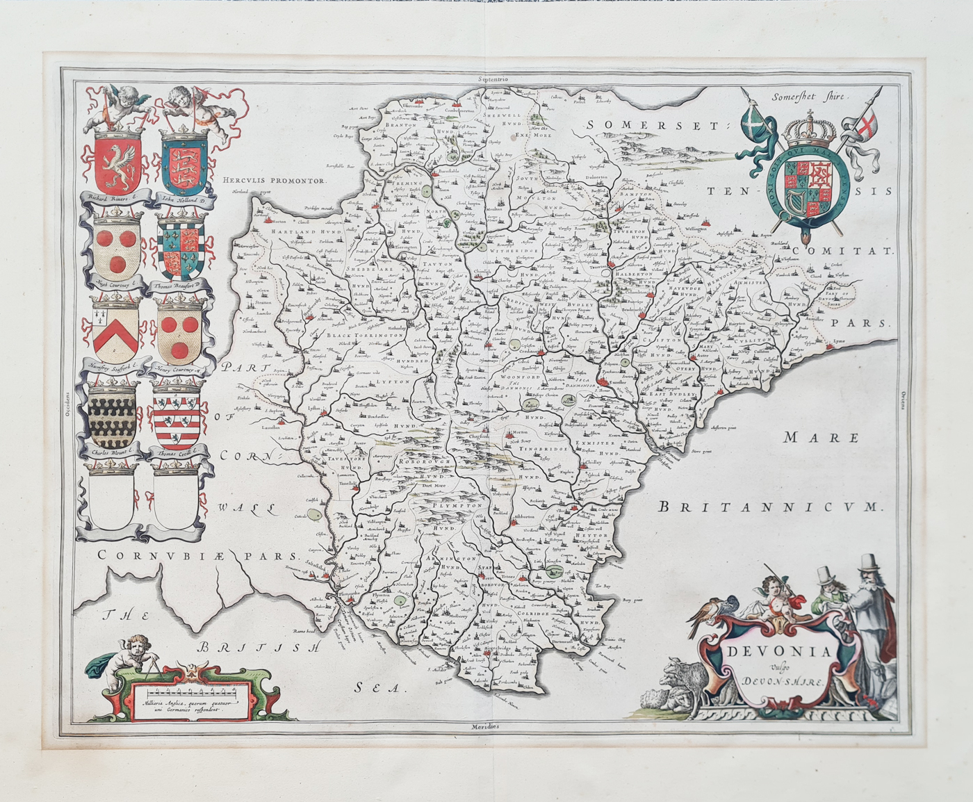
Map Title: DEVONIA Vulgo DEVONSHIRE
Publication: Theatrum Orbis Terrarum sive Atlas Novus.
Date: c. 1648
Description: A decorative 17th-century engraved map of Devonshire, featuring numerous ornamental crests and shields representing the nobility.
Condition: Later hand colouring, folding copy as published, Latin text verso. Nice attractive example, generous margins. Minor age related blemishes including old mount mark to margins.
Image size: 390 x 490mm
15.25 x 19.25". approx.
Price: SOLD
Order number: 4598
Original antique map supplied with free UK mainland delivery. Please contact us if you would like advice about framing.
Joan Blaeu Antique Map of Devonshire – c.1648
A decorative 17th-century engraved map of Devonshire, published by Joan Blaeu around 1648. An attractive example with ornamental coats of arms, later hand colouring and Latin text verso.
- Cartographer: Joan Blaeu
- Date: c.1648
- Map title: DEVONIA Vulgo DEVONSHIRE
- Medium: Engraved map with later hand colouring
- Image size: 390 × 490mm
- Order number: 4598
- Price: £465.00
About this Antique Map of Devonshire
Joan Blaeu's map of Devonshire, titled DEVONIA Vulgo DEVONSHIRE, is an attractive example of 17th-century Dutch cartography. It was published around 1648 as part of Blaeu's celebrated atlas, Theatrum Orbis Terrarum sive Atlas Novus.
The map is particularly decorative, with ornamental coats of arms and shields representing the nobility. Its elegant engraving and generous margins make it an appealing example of the elaborate county maps produced by the Blaeu publishing house.
This example has later hand colouring and retains its Latin text on the reverse. It is described as a folding copy as published, with minor age-related blemishes and an old mount mark to the margins.
Antique Maps by Joan (Johannes) Blaeu
Old and historical 17th century maps by Joan Blaeu .
A famous firm of Dutch cartographers and publishers was established in the late 16th century by Willem Janszoon Blaeu in Amsterdam. Blaeu was a maker of globes and scientific instruments and purchased some of his early map plates from Jodocus Hondius. From this small beginning was to emerge one of the largest and most prolific map publishing houses of the seventeenth century.
Willem's two sons, Joan and Cornelius, both entered the family business and in 1630 the firm published its first world atlas, bound in a single volume. This was increased to two volumes in 1635 and to three in 1640.
In 1645 Joan Blaeu published a county Atlas of England and Wales as part of his Atlas Novus, with maps based mainly on the earlier research of Saxton and Speed. The atlas was regarded as a masterpiece with a balanced style and calligraphic quality that has never been surpassed.
Explore more antique maps of Devonshire or browse our collection of antique maps by Joan Blaeu.
Mon - Closed
Tues-Fri 10am-1.30pm, 2.30-5.30pm
Sat 10am-1.30pm
© Devonshire Fine Art
 Free UK Mainland Delivery*
9 Church Street
Modbury
Devon PL21 0QW. UK
01548 830872


