
Antique Map of Devon by Thomas Moule, 1842-1858
Back to: Devon | Thomas Moule Maps
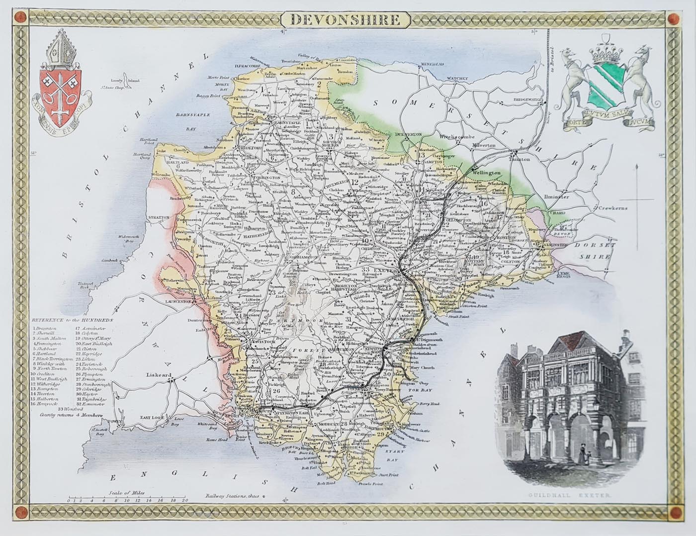
This attractive antique map of Devonshire was engraved by Thomas Moule and published between approximately 1842 and 1858. It features decorative hand colouring and an illustrated vignette of Exeter Guildhall, making it an appealing example of 19th-century English county cartography.
The map includes many of Devon's principal towns and settlements, including Exeter, Plymouth, Tavistock, Crediton, Dartmouth, Torquay, Brixham, Salcombe, Kingsbridge and Ivybridge. An interesting historical map for collectors of Devonshire maps and decorative antique prints.
Devonshire by Thomas Moule
Mapmaker: Thomas Moule
Publication: Barclay's English Dictionary
Date: 1842-1858
Area shown: Devonshire, England
Decorative features: Illustrated vignette of Exeter Guildhall, with later hand colouring.
Towns shown: Exeter, Plymouth, Tavistock, Crediton, Dartmouth, Torquay, Brixham, Salcombe, Kingsbridge and Ivybridge.
Condition: Bold imprint and later hand colouring. Some marks and blemishes.
Image size: 210 x 270mm (approximately 8.25 x 10.5 inches).
Original antique map – £78.00
Available unframed or professionally framed. Choose your preferred framing and glass options above. Free UK mainland delivery.
Order number: 4349
About this Antique Map of Devon by Thomas Moule
This decorative antique map of Devonshire was engraved by Thomas Moule and published in Barclay's English Dictionary during the period approximately 1842-1858. Moule is particularly well known for his attractive county maps of England and Wales, which combine geographical detail with decorative illustrations.
The map depicts Devon in the 19th century, including the important towns of Exeter, Plymouth, Tavistock, Dartmouth, Crediton and Torquay, together with other settlements across the county. A particularly attractive feature is the illustrated vignette of Exeter Guildhall.
The original map has later hand colouring and a bold imprint. Measuring approximately 210 x 270mm, it is a charming example of Victorian-era county cartography and an attractive addition to a collection of antique Devon maps.
This original antique map is available from Antique Maps Online for £78.00. It can be purchased unframed or with a choice of framing options.
Discover more examples in our collection of antique maps of Devon, or browse our wider selection of antique Thomas Moule county maps.
Buying and Framing Your Antique Devon Map
This is an original antique map, not a modern reproduction. It is available unframed or with a choice of framing options.
We offer free UK mainland delivery on qualifying orders. For further information, please see our delivery information.
For advice about framing your antique map, visit our antique map framing page.
Mon - Closed
Tues-Fri 10am-1.30pm, 2.30-5.30pm
Sat 10am-1.30pm
© Devonshire Fine Art
 Free UK Mainland Delivery*
9 Church Street
Modbury
Devon PL21 0QW. UK
01548 830872


