
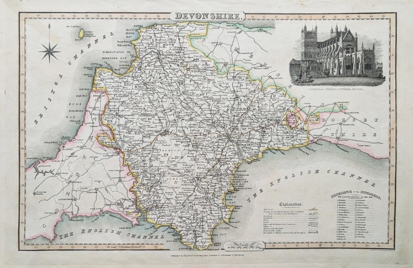
Antique Map of Devonshire by James Pigot, 1829
History and Features of the 1829 Devonshire Map
Cartographer: James Pigot
Publication: Pigot & Co.'s British Atlas of the Counties of England
Date: 1829
Edition: First edition
Engraving: Steel-plate line engraving
Colour: Early hand colouring
Decorative feature: Exeter Cathedral vignette
Condition: Age-toned paper, good bold imprint and early hand colouring.
Image size: 235 x 350mm (9.25 x 13.75 inches approximately).
Price: £130.00
Order number: 5010
Antique Map of Devonshire by James Pigot, 1829
This original antique map of Devonshire was published by James Pigot in 1829 as part of Pigot & Co.'s British Atlas of the Counties of England. It is an attractive early 19th-century county map, featuring decorative hand colouring and a vignette illustration of Exeter Cathedral.
Produced using steel-plate line engraving, the map provides a fascinating historical record of Devonshire during the early 19th century, before the major expansion of the county's railway network. Its combination of geographical detail, decorative presentation and historical interest makes it an appealing example of early British cartography.
James Pigot and His British County Atlas
James Pigot (fl. 1794–1842) was a Manchester-based publisher and engraver associated with directories and geographical publications. He initially worked on Dean's Manchester Directory before establishing his own publishing business.
His publications included commercial directories and county atlases, providing valuable information about British towns, counties and their development during the early 19th century.
This Devonshire map appeared in Pigot & Co.'s British Atlas of the Counties of England, published in 1829.
Decorative Features of the 1829 Devonshire Map
One of the attractive features of this antique map is its vignette of Exeter Cathedral, which adds decorative interest and a distinctive local connection.
The original early hand colouring enhances the presentation of the map, making it particularly suitable for collectors of Devonshire cartography and those interested in the history of the county.
Details of the Antique Devonshire Map
- Cartographer and publisher: James Pigot
- Publication: Pigot & Co.'s British Atlas of the Counties of England
- Date: 1829
- Edition: First edition
- Printing method: Steel-plate line engraving
- Colour: Early hand colouring
- Decorative feature: Exeter Cathedral vignette
- Image size: 235 × 350 mm (approximately 9.25 × 13.75 inches)
- Condition: Age-toned paper with a good bold imprint and early hand colouring
- Price: £130
Collecting Antique Maps of Devon
Early maps of Devonshire are popular with collectors because they record the county's towns, settlements and changing landscape before the extensive development of modern transport networks.
This 1829 map by James Pigot is an attractive example of early 19th-century county mapping and would make an interesting addition to a collection of antique Devon maps.
Explore our wider collection of antique maps of Devonshire to discover other original maps dating from the 17th, 18th and 19th centuries.
Frequently Asked Questions About Antique Maps of Devon
Who published the 1829 antique map of Devonshire?
The map was published by James Pigot in 1829 as part of Pigot & Co.'s British Atlas of the Counties of England.
What is shown on James Pigot's map of Devon?
The map depicts Devonshire and includes a decorative vignette of Exeter Cathedral. It is an early 19th-century steel-plate engraving with hand colouring.
Is the 1829 Devonshire map an original antique?
Yes. This is an original antique map dating from 1829, rather than a modern reproduction.
Can I have this antique map professionally framed?
Yes. We offer an antique map framing service. View our map framing options for further information.
Where can I find more antique maps of Devon?
Explore our antique maps of Devonshire collection to discover further original maps of the county from the 17th, 18th and 19th centuries.
Mon - Closed
Tues-Fri 10am-1.30pm, 2.30-5.30pm
Sat 10am-1.30pm
© Devonshire Fine Art
 Free UK Mainland Delivery*
9 Church Street
Modbury
Devon PL21 0QW. UK
01548 830872


