
England and Wales by John Wallis Geographical Pastime
Back to: Antique maps of the British Isles
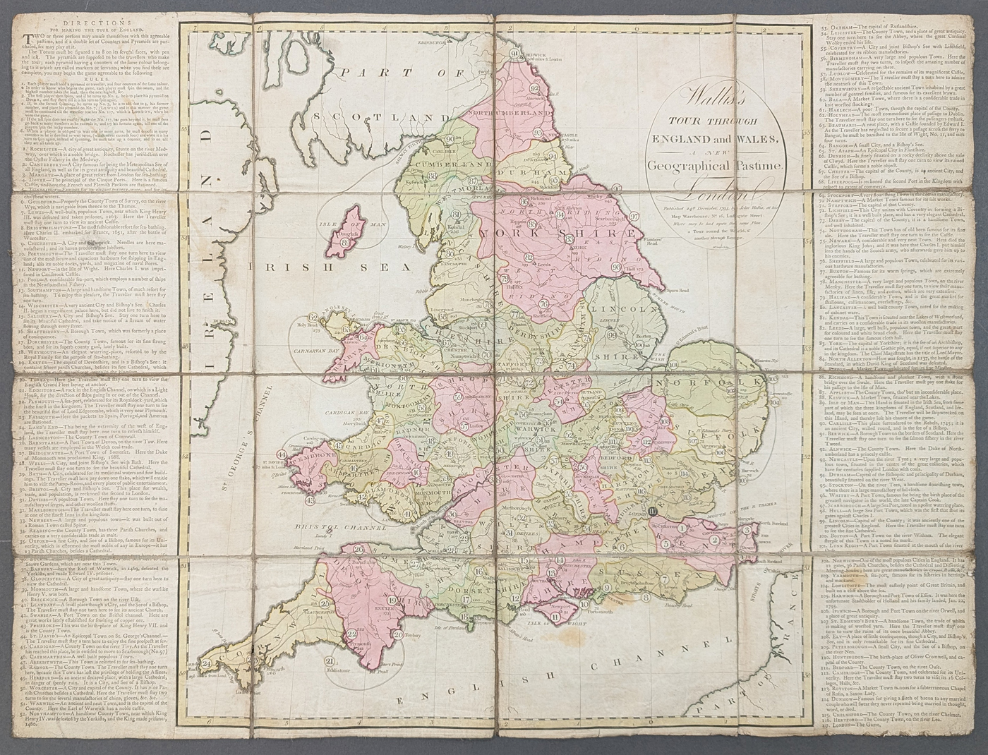
Title: Wallis's TOUR THROUGH ENGLAND AND WALES, A NEW Geographical Pastime - London
Publication: Published 24th December 1794, by John Wallis, at his Map Warehouse, No. 16 Ludgate Street: Where may be had upon the same Plan, a Tour around the World, & another through Europe.
Date: 1794
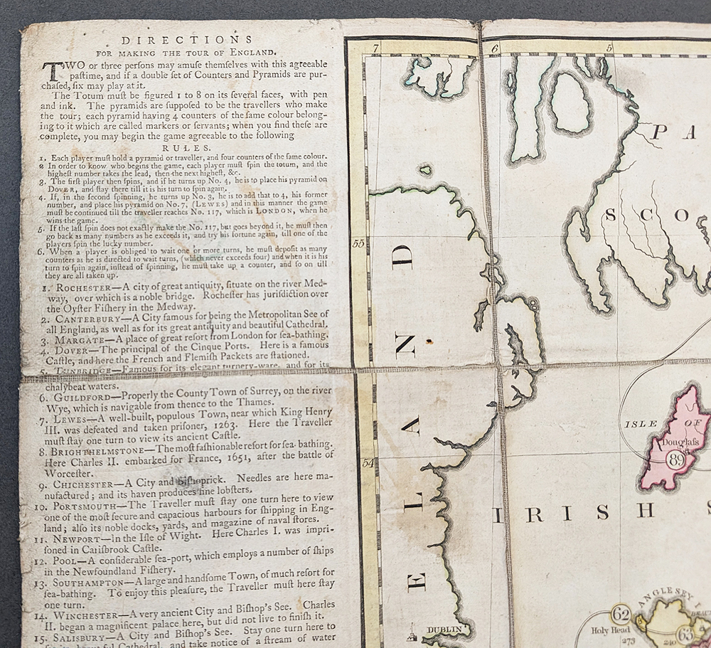
Description: A cartographic board game published during the reign of George III, engraved by McIntyre. This fascinating item has a set of rules to the top left and purpose of the game is to navigate England and Wales using counters and a 'Totum' (an 8-sided die or dice). Towns and cities each have a number along with a brief description and in some cases instructions such as 'miss a go'.
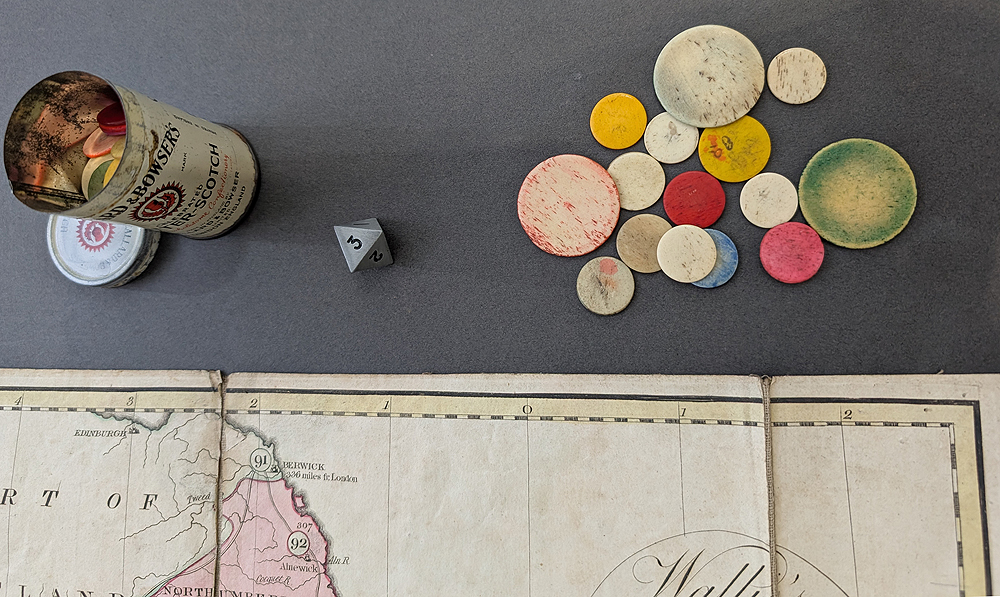
The instructions state that each player should have a pyramid and four counters. In our case we have bone counters, large and small contained in a miniature Callard and Bowser Butter-Scotch tin as well as an 8-sided Totum.
Condition: Dissected and laid on linen, original hand colouring, copperplate line engraving. Numerous light stains and marks, slight fraying to edges. It has, been played with!
Image size: 507 x 668mm, 20 x 26.25" approx.
£595.00
Order No. 4933
Click here for framing suggestions
18th century geographical board game by John Wallis
Watch the video
Mon - Closed
Tues-Fri 10am-1.30pm, 2.30-5.30pm
Sat 10am-1.30pm
© Devonshire Fine Art
 Free UK Mainland Delivery*
9 Church Street
Modbury
Devon PL21 0QW. UK
01548 830872


