
Antique Sea Chart of Fowey and Mounts Bay, Cornwall, c.1693
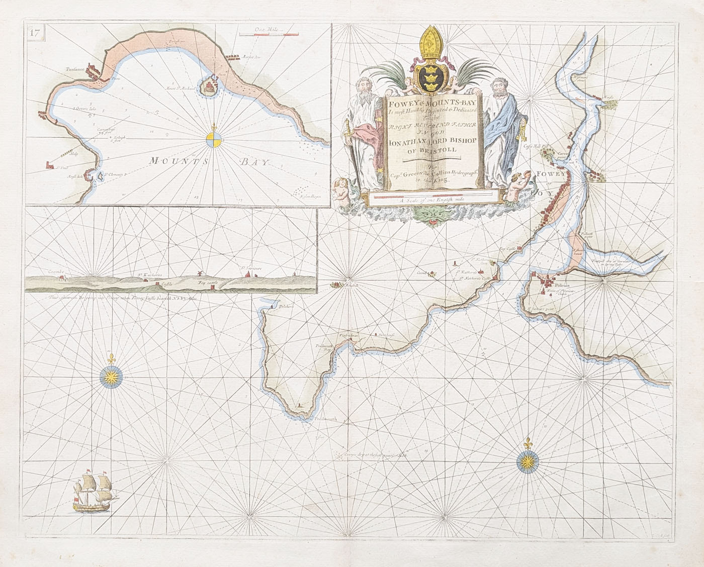
Fowey and Mounts Bay by Captain Greenville Collins
Publication: The British Coasting Pilot
Date: Circa 1693
Subject: Fowey and Mounts Bay, Cornwall
Engraver: La Clerk (verify attribution)
An antique 17th-century sea chart of Fowey and Mounts Bay, Cornwall, published in Captain Greenville Collins's The British Coasting Pilot, circa 1693. The chart features a decorative title cartouche.
Condition: Good imprint; folding copy as published; later hand colouring.
Chart size: 460 × 572 mm (approximately 18 × 22.5 inches).
Price: £225.00
Order number: 4764
Antique map framing suggestions
Greenville Collins and The British Coasting Pilot
Captain Greenville Collins was a prominent English hydrographer whose surveys contributed to the development of detailed printed charts of the British coastline. His work is associated with The British Coasting Pilot, a significant collection of coastal charts published in the late 17th century.
This antique chart of Fowey and Mounts Bay relates to Cornwall's maritime history. Coastal charts helped mariners identify shorelines and navigate waters used by fishing vessels, merchant ships and other coastal traffic. Its engraved detail and decorative cartouche also make it of interest to collectors of historic maps and nautical prints.
Collecting antique maps of Cornwall
Antique charts of Cornwall appeal to collectors interested in the county's ports, coastal geography and maritime past. A chart's date, publication history, condition, colouring and provenance can all influence its collecting interest.
Explore antique maps of Cornwall and browse our antique sea charts. You can also view more charts by Greenville Collins .
Frequently asked questions
Who was Captain Greenville Collins?
Greenville Collins was an English hydrographer known for his work surveying and charting the coast of Great Britain in the 17th century.
What is The British Coasting Pilot?
It is the title associated with Collins's collection of British coastal charts, published in the late 17th century.
Is this an original antique chart?
This item is offered as an antique chart dating to circa 1693. Please refer to the product details and photographs for its stated condition, colouring and physical characteristics.
Can the chart be framed?
Yes. See our antique map framing suggestions for information about framing options.
Mon - Closed
Tues-Fri 10am-1.30pm, 2.30-5.30pm
Sat 10am-1.30pm
© Devonshire Fine Art
 Free UK Mainland Delivery*
9 Church Street
Modbury
Devon PL21 0QW. UK
01548 830872


