
Antique Map of Jersey, circa 1831 – Creighton & Walker
Browse our antique maps of the Channel Islands or see more antique maps by John and Charles Walker.
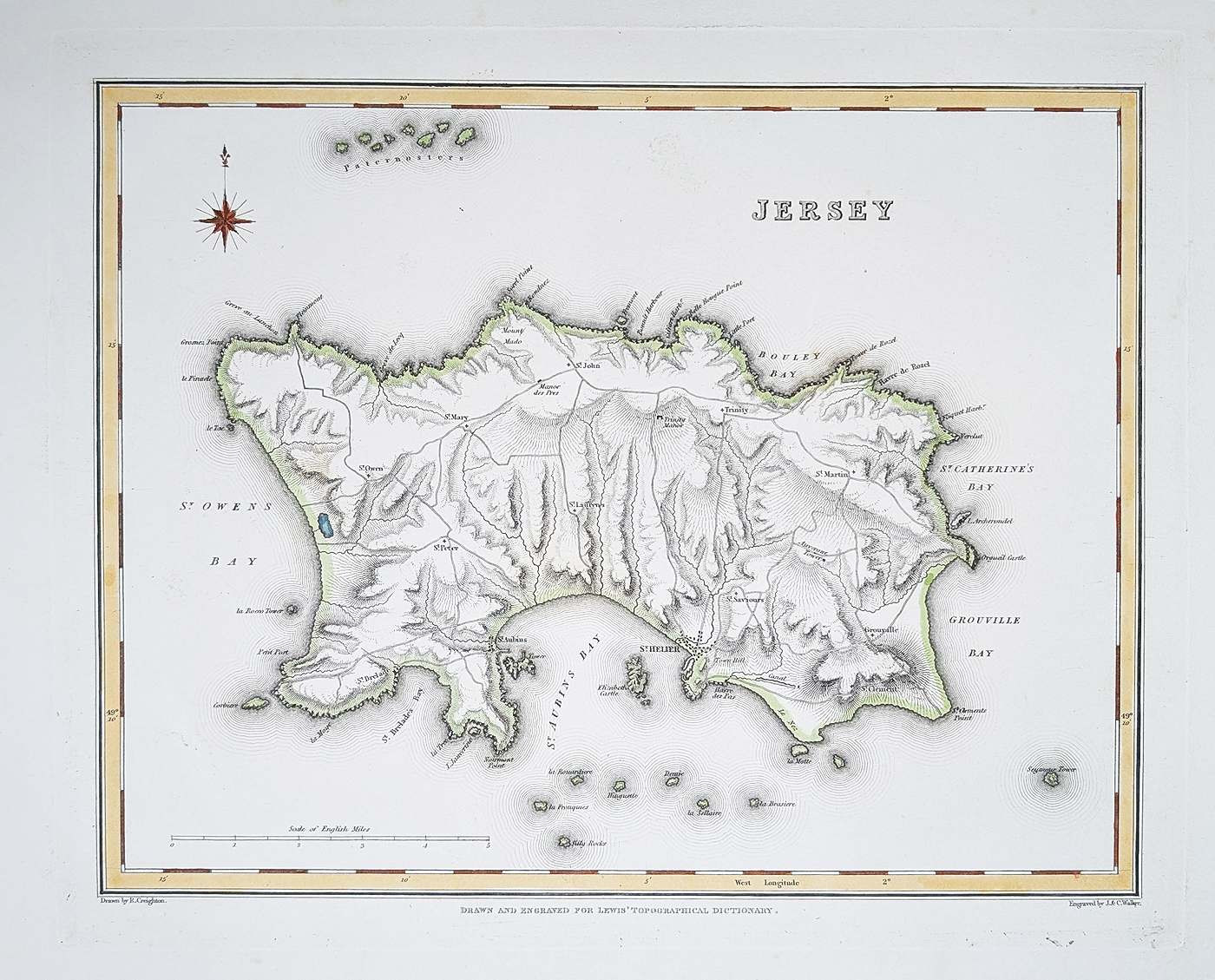
Antique map of Jersey by Creighton and Walker
This antique map of Jersey dates from circa 1831 and is associated with Robert Creighton and the engravers and publishers John and Charles Walker. It was published in Lewis's Topographical Dictionary, a geographical reference work of the early 19th century.
The map provides a historical representation of Jersey, including St. Helier, St. Aubin's and St. Peter's. It offers an interesting record of the island's towns and geography during the early Victorian period.
This original 19th-century map has later hand colouring. The paper is in good condition, with a bold imprint and minor age-related blemishes.
The printed image measures approximately 210 x 270mm (8.25 x 10.5 inches).
Map details
- Mapmaker: Robert Creighton
- Engraver and publisher: John and Charles Walker
- Publication: Lewis's Topographical Dictionary
- Date: Circa 1831
- Area: Jersey, Channel Islands
- Colouring: Later hand coloured
- Condition: Good paper, bold imprint and minor age-related blemishes
- Image size: 210 x 270mm (8.25 x 10.5 inches)
- Order number: 4834
- Price: £34.95
- Free UK mainland delivery. Secure online ordering.
Jersey in the early 19th century
This antique map provides a historical view of Jersey as it appeared around 1831. Published in Lewis's Topographical Dictionary, it belongs to a period when printed geographical reference works helped readers understand the towns, settlements and geography of the British Isles and the Channel Islands.
The map is an original 19th-century item with later hand colouring. It may appeal to collectors of antique maps of Jersey, Channel Islands history and early British cartography.
Frequently Asked Questions
Who made this antique map of Jersey?
The map is associated with Robert Creighton and was engraved and published by John and Charles Walker.
When was the Jersey map published?
It dates from approximately 1831 and was published in Lewis's Topographical Dictionary.
Is this an original antique map?
Yes. This is an original 19th-century map, not a modern reproduction.
Is the map hand coloured?
Yes. The map has later hand colouring.
What size is the Jersey map?
The printed image measures approximately 210 x 270mm (8.25 x 10.5 inches).
Mon - Closed
Tues-Fri 10am-1.30pm, 2.30-5.30pm
Sat 10am-1.30pm
© Devonshire Fine Art
 Free UK Mainland Delivery*
9 Church Street
Modbury
Devon PL21 0QW. UK
01548 830872


