
Antique Map of London c.1879 by G. W. Bacon
This large original antique map of London dates from circa 1879 and was produced by G. W. Bacon for Cassell's Old and New London. This detailed Victorian street map shows London and its surrounding districts from Hammersmith and Fulham in the west to the West India Docks in the east, with Clapham Common to the south and Highbury to the north. Measuring approximately 710 x 985mm, this large antique London map has later hand colouring and is an impressive example of Victorian cartography.
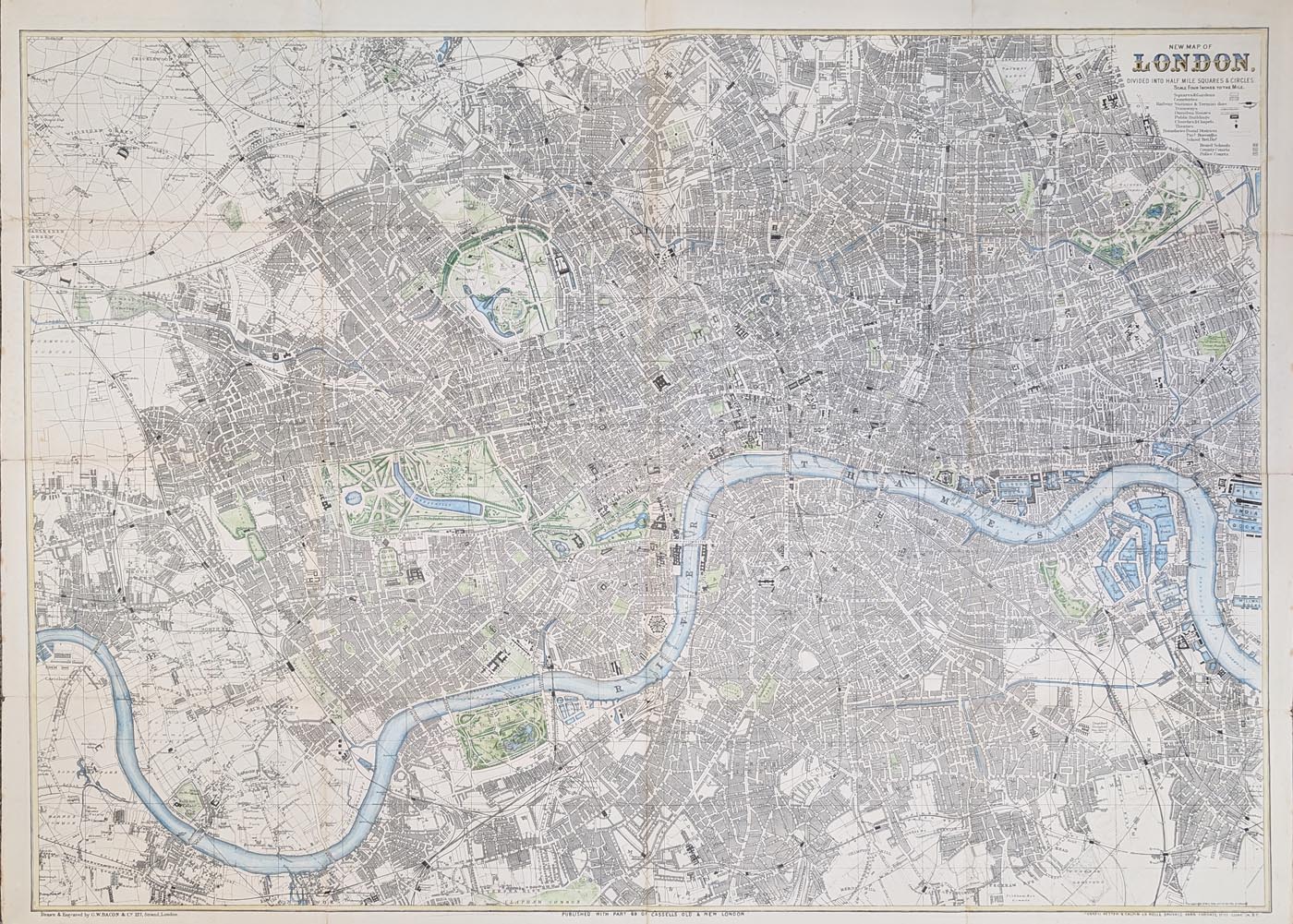
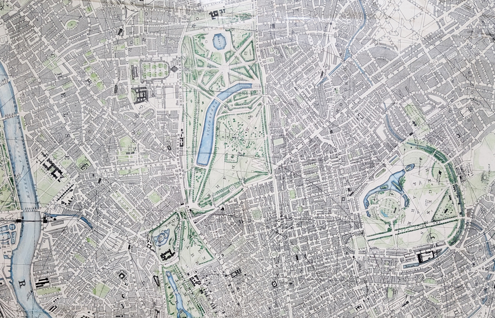
A New Map of London Divided into Half-Mile Squares and Circles
Publisher: Cassell, Petter and Galpin
Mapmaker: George Washington Bacon
Date: c.1879
Publication: Cassell's Old and New London
Coverage: London, Hammersmith, Fulham, Clapham, Highbury and the West India Docks
Scale: Four inches to the mile
Format: Large folding lithographed street map
£395.00
Condition: Folding copy as published, with some wear and reinforcing to folds, minor repairs to the margins and later hand colouring.
Image size: 710 x 985mm (approximately 28 x 38.75 inches)
Free UK Mainland Delivery
Victorian Street Map of London by G. W. Bacon
This original large-format Victorian street map of London dates from circa 1879 and was produced by G. W. Bacon for Cassell's Old and New London. It covers a substantial area of the capital and provides a fascinating record of London's streets and suburbs during the late nineteenth century.
The map extends from Hammersmith and Fulham in the west to the West India Docks in the east, and from Clapham Common to Highbury. Measuring approximately 710 x 985mm, it is an impressive large antique London map for collectors, historians and anyone interested in the development of Victorian London.
George Washington Bacon
George Washington Bacon (1830–1922) was an American-born cartographer, map publisher and bookseller who became an important figure in Victorian British cartography. Born in Lockport, New York, in 1830, he was the son of bookseller James Bacon. He moved to London in 1861 and initially worked in the publishing trade, including a period associated with the American atlas publisher Joseph Colton.
Bacon was an energetic and entrepreneurial businessman and was involved in a variety of ventures during the early part of his career, including the import and sale of maps and books. He was elected a Fellow of the Royal Geographical Society in 1866, sponsored by Edward Stanford and Alexander George Findlay. Following financial difficulties, he returned his attention to map publishing and established his own business, Bacon & Co.
Bacon & Co. became well known for producing a wide range of maps, including detailed maps of London, large-scale maps of the British Isles and portable folding maps. The firm also developed and reworked existing copper and steel printing plates, allowing Bacon to produce updated editions with clearer lettering, revised geographical information and increased use of colour.
One of Bacon's notable publications was The New Ordnance Atlas of the British Isles, first published in 1883. His work reflected the growing Victorian demand for accurate and detailed maps for travel, reference and education. Bacon's large-scale maps of London are particularly interesting today because they record the rapidly expanding Victorian city, its streets, suburbs, railway connections and industrial areas.
After becoming a British citizen in 1871, Bacon continued to expand his publishing business. In 1893 he acquired the map business of James Wyld, strengthening Bacon & Co.'s position in the London map-publishing trade. The company subsequently developed an extensive catalogue of maps covering London, Britain and the wider world.
Bacon & Co. continued as an established map publisher into the twentieth century. The business was eventually acquired by the Scottish publishing company W. & A. K. Johnston, which continued to use the Bacon & Co. name for many years. George Washington Bacon died in 1922.
Today, maps by George Washington Bacon are collected for their detailed depiction of Victorian Britain and, particularly, for their record of the changing landscape of nineteenth-century London. His large-scale London maps provide a fascinating historical record of the capital during a period of rapid urban growth and development.
Conservation Framing for This Large Antique Map of London
Because this original map measures approximately 710 x 985mm, professional conservation framing can provide an attractive way to display and protect it. We can advise on suitable conservation framing options, including appropriate mounting and glazing for an antique map of this size.
See our conservation framing options for antique maps
Related Antique Maps of London
- Antique Map of London by Thomas Moule
- Antique Map of London by James Reynolds
- Antique Map of London and Westminster
Frequently Asked Questions
Who made this antique map of London?
The map was produced by G. W. Bacon for Cassell, Petter and Galpin.
When was the map published?
The map dates from circa 1879 and was published in connection with Cassell's Old and New London.
How large is the London map?
The map measures approximately 710 x 985mm, or 28 x 38.75 inches.
Can this antique London map be framed?
Yes. We can advise on suitable conservation framing options for this large original antique map.
Mon - Closed
Tues-Fri 10am-1.30pm, 2.30-5.30pm
Sat 10am-1.30pm
© Devonshire Fine Art
 Free UK Mainland Delivery*
9 Church Street
Modbury
Devon PL21 0QW. UK
01548 830872


