
London during the English Civil War by Walter Harrison
Back to: London
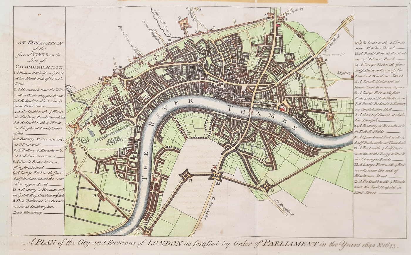
Title: A plan of the city and environs of London as fortified by order of Parliament in the years 1642 & 1643
Publication: Published for Harrison's History of London by John Cooke, Shakespeare's Head, Pater Noster Row, in seventy weekly parts.
Date: c.1775
Description: Retrospective, 18th century map depicting the City during the English Civil War and before the Great Fire. Engraved for "A New and Universal History, Description, and Survey Of The Cities Of London and Westminster, The Borough of Southwark, And Their Adjacent Parts. Including not only all the Parishes within the Bills of Mortality but the Towns, Villages, Palaces, Seats, and Country, to the extent of Twenty Miles round, Comprising A Circle Of Near One Hundred And Fifty Miles". The map shows and a numbered key describes the fortifications put in place to defend London from the Royalist forces in the Civil War. Parliamentary forces built a defensive wall around London, including a fort at Hyde Park Corner and a battery on Constitution Hill. With no such attack forthcoming, they were demolished in 1647. Two side panels provide a key to the 23 forts on the lines of defence.
This edition is without the later inscription at the top, 'Engraved for Harrison's Hiftory of London'.
Condition: Folding copy as published, old tape mark to verso of top edge, image unaffected. Later hand colouring.
Image size: 205 x 320mm approx.
SOLD
Order No. 4457
Click here for framing suggestions
18th century retrospective map of London in the 17th century.
Mon - Closed
Tues-Fri 10am-1.30pm, 2.30-5.30pm
Sat 10am-1.30pm
© Devonshire Fine Art
 Free UK Mainland Delivery*
9 Church Street
Modbury
Devon PL21 0QW. UK
01548 830872


