
Antique Street Map of London, 1884 – Post Office Directory
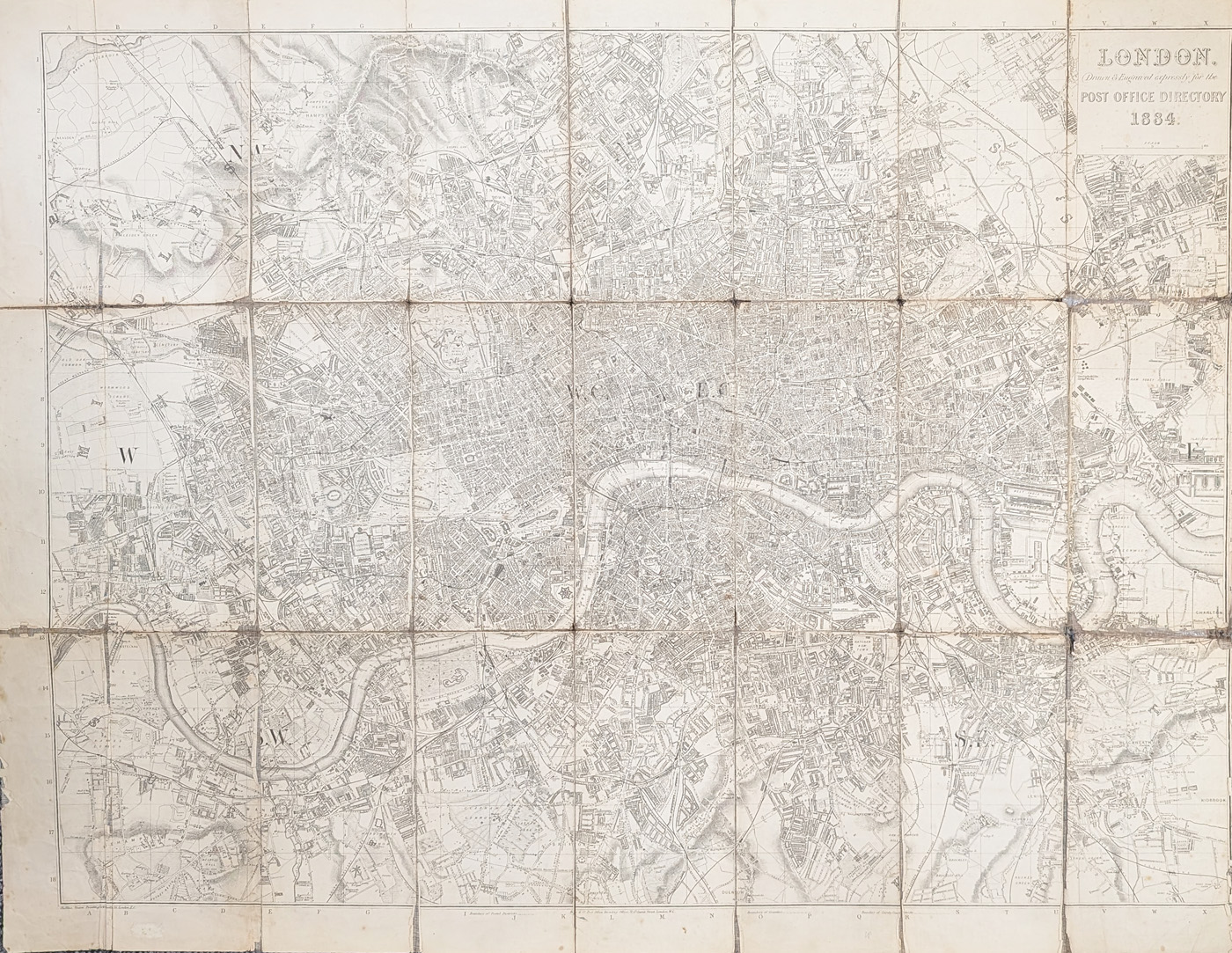
Title: LONDON Drawn & Engraved for the POST OFFICE DIRECTORY 1884
Publication: Cheffins, Steam Printing Works, 6 Castle Street, London EC
Date: c.1884
Description: Extensive map of the city by Kelly and Co. at the Post Office Directory, 51 Gt. Queen Street, London WC
Condition: Folding map as published, lithograph laid on linen, reinforcing to folds, wear and loss to fold lines, right margin cropped, priced accordingly.
Image size: 406 x 665mm, 16 x 26.25" approx.
£95.00
Order No. 4254
Antique map framing suggestions
Original Victorian London Map by Kelly & Co., 1884
This original antique street map of London was prepared for the Post Office Directory in approximately 1884. Associated with Kelly & Co., the map offers a fascinating record of London during the Victorian period, when the capital was undergoing considerable urban growth and development.
Produced as a practical street map for a contemporary directory, it is an appealing piece for collectors of antique London maps, Victorian cartography and historical urban plans. It may also interest anyone researching the development of London's streets and built environment in the nineteenth century.
Explore our collection of antique maps of London to discover other historic plans of the capital.
Details and Condition of the 1884 London Map
- Title: London, drawn and engraved for the Post Office Directory, 1884
- Attribution: Kelly & Co.
- Publication: Cheffins, Steam Printing Works, 6 Castle Street, London EC
- Date: Circa 1884
- Medium: Lithograph laid on linen
- Format: Folding map as published
- Image size: 406 × 665 mm (approximately 16 × 26.25 inches)
- Condition: Reinforcement to folds, wear and losses along fold lines, and a cropped right margin. Priced accordingly.
- Price: £95.00
- Reference: 4254
Buying and Framing This Antique London Map
This nineteenth-century London street map is available for £95.00, subject to availability. Please review the condition description carefully before ordering, as the map has wear and losses along the folds and a cropped right margin.
If you would like to display the map, see our antique map framing suggestions. For information about delivery, visit our delivery information page.
Frequently Asked Questions
How old is this London street map?
The map dates from approximately 1884, during the Victorian period.
Who published the map?
It was prepared for the Post Office Directory and is associated with Kelly & Co. The publication details also identify Cheffins, Steam Printing Works, at 6 Castle Street, London EC.
What is the condition of the map?
The folding lithograph is laid on linen. The folds have been reinforced, but there is wear and loss along the fold lines and the right margin has been cropped. The price reflects this condition.
How large is the map?
The image measures 406 × 665 mm, approximately 16 × 26.25 inches.
Can the map be framed?
Framing may be possible, depending on the map's condition and intended display. See our antique map framing suggestions for further information.
Mon - Closed
Tues-Fri 10am-1.30pm, 2.30-5.30pm
Sat 10am-1.30pm
© Devonshire Fine Art
 Free UK Mainland Delivery*
9 Church Street
Modbury
Devon PL21 0QW. UK
01548 830872


