
Antique Map of Penzance to Land's End by Emanuel Bowen and John Owen
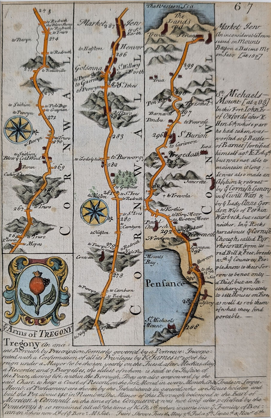
Antique Road Map of Penzance to Land's End
Mapmakers: Emanuel Bowen and John Owen
Publication: Britannia Depicta or Ogilby Improved
Date: Circa 1720–1764
Subject: Historic road from Penzance to Land's End, Cornwall
Verso: London to Newhaven road description.
Condition: Good paper and imprint, with later hand colouring.
Image size: 190 x 120mm (7.5 x 4.75 inches) approximately.
Price: £40.00
Order number: 3343
Historical Background of the Penzance to Land's End Map
This original antique road map of Penzance to Land's End in Cornwall was published by Emanuel Bowen and John Owen in Britannia Depicta or Ogilby Improved. Dating from circa 1720–1764, it provides a fascinating glimpse of the roads, settlements and landscape of the far south-western tip of Cornwall during the 18th century.
The map depicts the historic route between Penzance and Land's End, an area renowned for its rugged coastline, historic fishing communities and distinctive Cornish landscape. It is an interesting example of early British road mapping, produced during a period when printed road maps were becoming increasingly useful to travellers.
Emanuel Bowen was an important 18th-century engraver, mapmaker and publisher. Britannia Depicta developed on the earlier road mapping work of John Ogilby, presenting detailed maps of British roads in a convenient format.
This attractive little antique map would make an interesting addition to a collection of Cornwall antique maps, particularly for anyone interested in Penzance, Land's End or the historical roads of Britain.
Explore more of our antique maps of Cornwall and our collection of antique road maps of Britain.
Frequently Asked Questions
Who made the Penzance to Land's End antique map?
The map was produced by Emanuel Bowen and John Owen and published in Britannia Depicta or Ogilby Improved, an important 18th-century atlas of British road maps.
When was this antique road map published?
This antique road map is dated circa 1720–1764. It provides an interesting historical record of the roads and landscape of the far south-western tip of Cornwall during the 18th century.
Is this an original antique map?
Yes, this is an original antique printed map, not a modern reproduction. It has later hand colouring and retains good paper and imprint.
Mon - Closed
Tues-Fri 10am-1.30pm, 2.30-5.30pm
Sat 10am-1.30pm
© Devonshire Fine Art
 Free UK Mainland Delivery*
9 Church Street
Modbury
Devon PL21 0QW. UK
01548 830872


