
North and South Poles by Pinkerton 1812
Back to: World | Miscellaneous
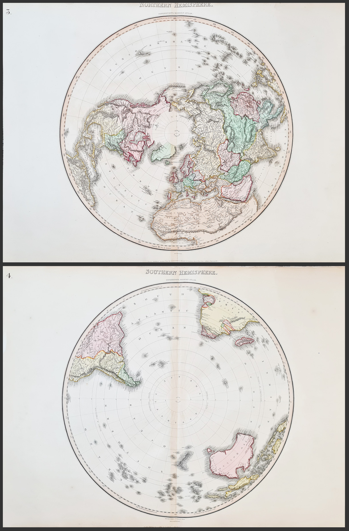
Title: Northern and Southern Hemispheres
Publication: Pinkerton's Modern Atlas, published by Cadell & Davies, Strand, Longman Hurst Rees Orme and Brown, Paternoster Row.
Date: October 1st 1812 and August 31st 1812
Description: Large, copperplate engravings of the North and South Poles in the reign of George III, before detailed exploration. Engraved by Samuel John Neele. Sheets 3 and 4 from the atlas. One of the best English Atlases of the period. Original hand colouring. A rare opportunity to purchase both North and South hemispheres.
Pinkerton was an Edinburgh archaeologist, numismatist, author, geographer and publisher, published several geography books and atlases. The Modern Atlas was first issued in parts beginning in 1808 and was issued as a whole in 1815. The atlas represents the culmination of Pinkerton's cartographic output, and it presents as accurate a picture of the world as was available in the 19th century.
Condition: Large side margins, close margins top and bottom as published. Repaired splits to edges, some age toning, folding copies as published.
Sheet size: 562 x 745mm, 22 x 29.25" each approx.
£795.00 pair
Order No. 4563
Click here for framing suggestions
Samuel John Neele 1758-1824
Father of Josiah Neele (fl. 1826-45), they were prolific engravers who produced maps for many atlases and topographical works, including town plans and county soil maps. They are best known for their elegant series of county maps published in parts by John Wilkes and others in the Encyclopaedia Londinenis and the plain maps first published in The New British Traveller. Josiah Neele also later worked with George and James Neele.
Works published include:
The Modern Royal Atlas - c.1800
Minor Atlas - 1813.
Mon - Closed
Tues-Fri 10am-1.30pm, 2.30-5.30pm
Sat 10am-1.30pm
© Devonshire Fine Art
 Free UK Mainland Delivery*
9 Church Street
Modbury
Devon PL21 0QW. UK
01548 830872


