
Antique Map of London 1824 by Samuel Leigh and Sidney Hall
This original antique map of London dates from 1824 and was published by Samuel Leigh, with the map engraved by Sidney Hall. A detailed street map of the capital, it shows areas including St Katherine's Docks, Trafalgar Square, the National Gallery, Kentish Town, Shadwell, Kennington and Paddington. Measuring approximately 480 x 595mm, it provides a fascinating record of London in the early nineteenth century.
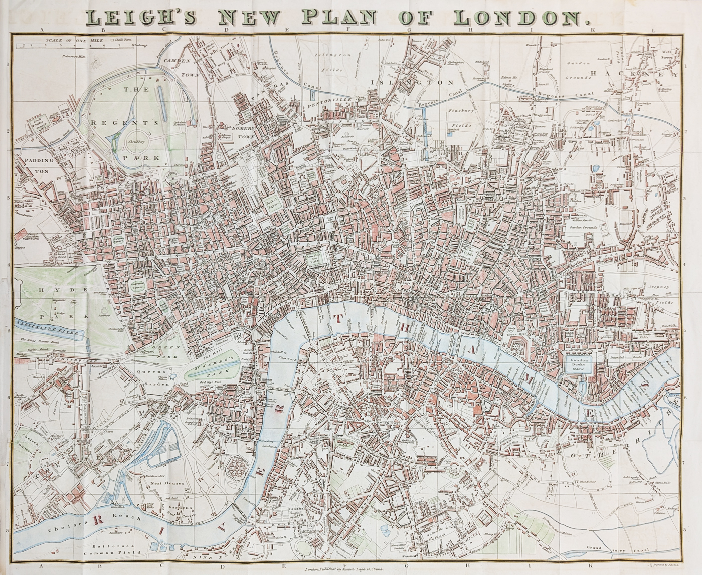
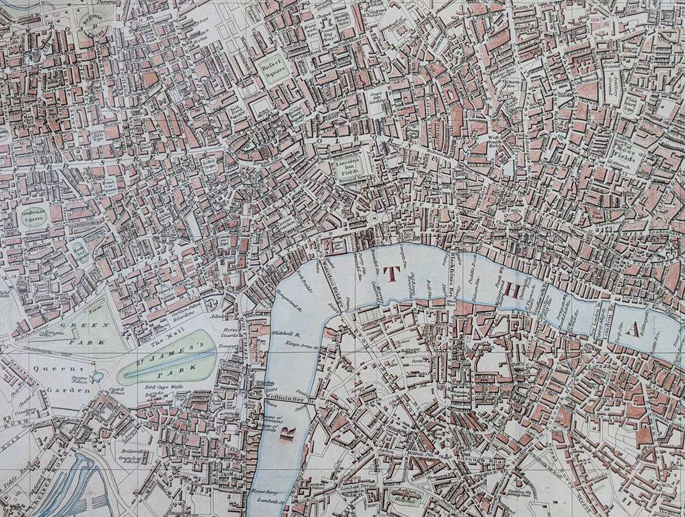
Leigh's New Plan of London, 1824
Publisher: M. A. Leigh, 421 Strand, London
Date: 1824
Engraver: Sidney Hall
Subject: London street map
Coverage: Kentish Town, Shadwell, Kennington, Paddington and surrounding areas
Notable features: St Katherine's Docks, Trafalgar Square, the National Gallery and detailed London streets
Format: Folding map as published, with later hand colouring
Image size: 480 x 595mm (approximately 19 x 23.5 inches)
Condition: Folding copy as published, later hand colouring, with a close left margin
£445.00
Antique Map of London 1824 by Samuel Leigh and Sidney Hall
Order No. 4709
Free UK Mainland Delivery
Explore conservation framing options for this 1824 London map
This large antique London map is well suited to professional conservation framing. We can advise on suitable mounting, glazing and frame styles to help protect the map while presenting it for display.
Description
Large and detailed street map of London engraved by Sidney Hall, featuring St Katherine's Docks, Trafalgar Square and the National Gallery. The map is squared and border lettered and numbered for reference. It extends from Kentish Town and Paddington to Shadwell and Kennington.
Antique Map of London 1824
This detailed antique street map provides an interesting view of London in 1824 during the reign of George IV. Published by Samuel Leigh and engraved by Sidney Hall, the map records the rapidly developing capital before the major expansion and redevelopment of the Victorian period.
The map extends from Kentish Town and Paddington in the west and north to Shadwell and Kennington, showing London's streets, districts and developing urban landscape in considerable detail.
Samuel Leigh and Sidney Hall
Samuel Leigh was a London publisher associated with guidebooks, maps and travel publications. This 1824 map was engraved by Sidney Hall, one of the notable British map engravers of the nineteenth century. Hall's detailed engraving gives the map considerable visual and historical interest.
Places Shown on the 1824 London Map
The map includes many areas and landmarks of historical interest, including St Katherine's Docks, Trafalgar Square, the National Gallery, Kentish Town, Shadwell, Kennington and Paddington. The detailed street network provides an interesting picture of London before the extensive urban changes of the Victorian era.
London in 1824
Published in 1824, this map records London during the reign of George IV, when the capital was already undergoing substantial growth. It provides a valuable visual record of the city's streets, districts and landmarks in the early nineteenth century, before many later Victorian developments transformed London.
Conservation Framing for the 1824 London Map
With an image size of approximately 480 x 595mm, this large antique London map makes an impressive display piece. Conservation framing can provide attractive presentation while helping protect the map from unnecessary handling, dust and environmental conditions.
We can advise on suitable conservation mounting, glazing and frame styles for this historic map. Explore our conservation framing options for antique maps.
Related Antique Maps of London
Mon - Closed
Tues-Fri 10am-1.30pm, 2.30-5.30pm
Sat 10am-1.30pm
© Devonshire Fine Art
 Free UK Mainland Delivery*
9 Church Street
Modbury
Devon PL21 0QW. UK
01548 830872


